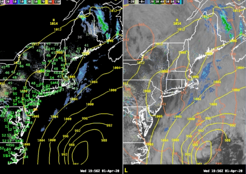
Wednesday’s weather panned out pretty much as advertised as the day started sunny and then clouds have begun to slide in. Most of the cloudiness right now is of the mid and high variety but, looking at the satellite loop, lower clouds containing rain are advancing in from the east. From the east? Yup!
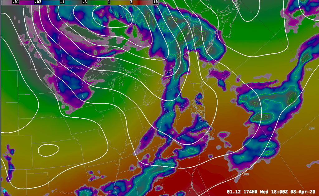
A storm system is currently spinning away to our south and has turned our winds locally into the NE. This has thrown quite a bit of moisture back at us and that process is only just starting. As the night progresses we will see this system start to really wind up and it will begin to perform a loop out at sea. As the storm loops through the day tomorrow it will throw clouds and rain back toward New England. The loop from the NAM12 model (shown below) demonstrates this process happening, at least in the mind of the model, pretty clearly.

The other computer models GFS, European and Canadian models all support this idea of the low looping around. The overall pattern also supports this due to high latitude blocking around Greenland that continues to be the major weather feature on the global weather models. This feature is jamming up the upper level weather pattern and in turn storms near the surface also get caught in this atmospheric log jam.

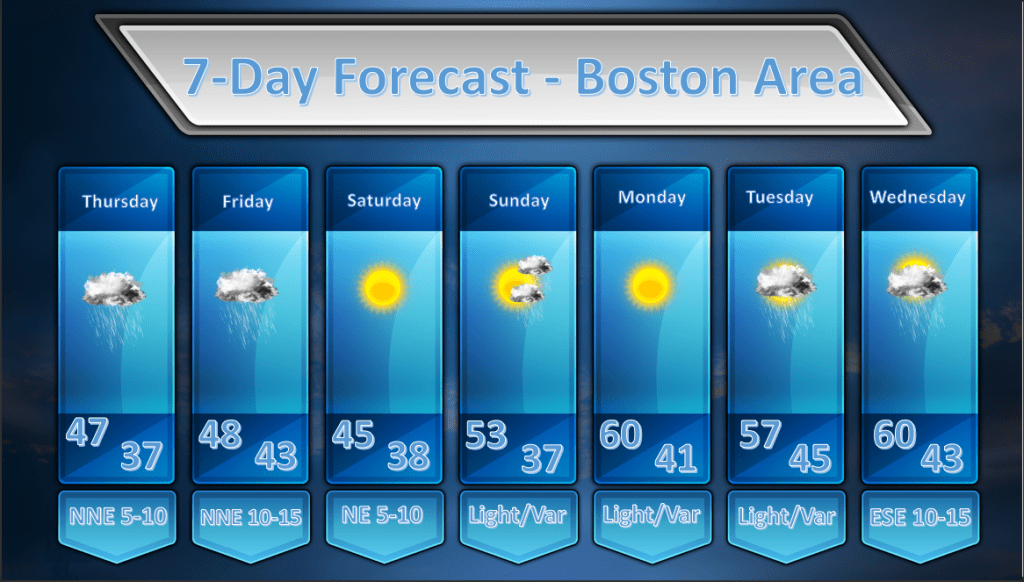
Fortunately this block is in the process of breaking down and soon the normal west to east progression of weather events will resume. The forecast reflects that with some rainfall on Thursday and Friday. The sun should return by Saturday as the storm finally shoves off and an upper level ridge of high pressure builds over the eastern US. On Sunday a weak frontal boundary will transit across the area and this may lead to a fairly cloudy day with the risk of a shower or two.
By Monday the sun should come back out and a fairly light WSW wind should develop. This will allow temperatures to rocket up into the low 60’s. I’m being conservative with the temperature forecast on Monday but, if we stay relatively clear, temperatures could even go into the mid 60’s or better.
Tuesday looks like a cloudy and mild day with the risk of a shower or two as a warm front tries hard to push northward into New England but I don’t think it’s going to get very far. Wednesday will be another mild and kind of cloudy day as we watch a cold front approaching from the west.