Issued April 7 2020 – 10:15 am
FORECAST DISCUSSION:
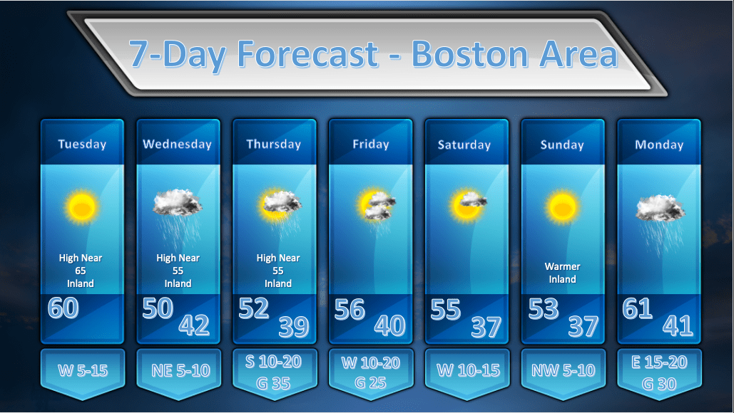
TODAY: A beautiful day. Clear skies with high temperatures that should get into the 60-65 degree range with light winds.
WEDNESDAY: Clouds will be on the increase during the overnight hours Tue into Wed and light rain should break out primarily after 2am. A wave of low pressure will pass south of Long Island during the day and this should generate some light rain/drizzle for the better part of the day. The models do indicate some mid-level dry air trying to work in during the late afternoon hours and its possible that we will see some breaks in the overcast late in the day toward sunset.
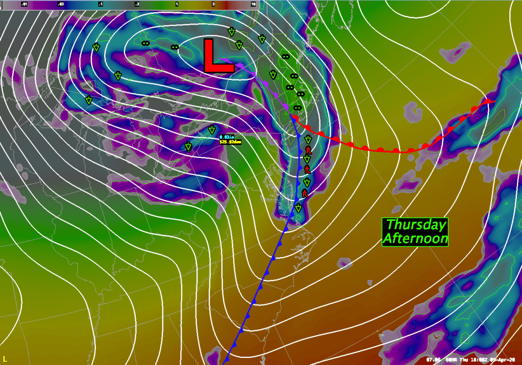
THURSDAY: The fast moving weather pattern will bring our next weather maker along for Thursday. A strong cold front will be sweeping through western New York on Thursday morning and that front will reach the vicinity of the Boston area by the late afternoon hours. There could be a period of heavy showers and/or a period of steady rain as the front moves through. The timing on this looks to be between noon and 4pm. If it were warmer and a bit more humid I would probably throw in the chance of a rumble of thunder as the front pushes through but I’m leaving it out now. Don’t be surprised if it happens! There will be strong and gusty winds associated with this front’s approach. Gusts upward of 30 mph will be possible in metro Boston and possibly upwards of 50 mph on the Cape and Islands.
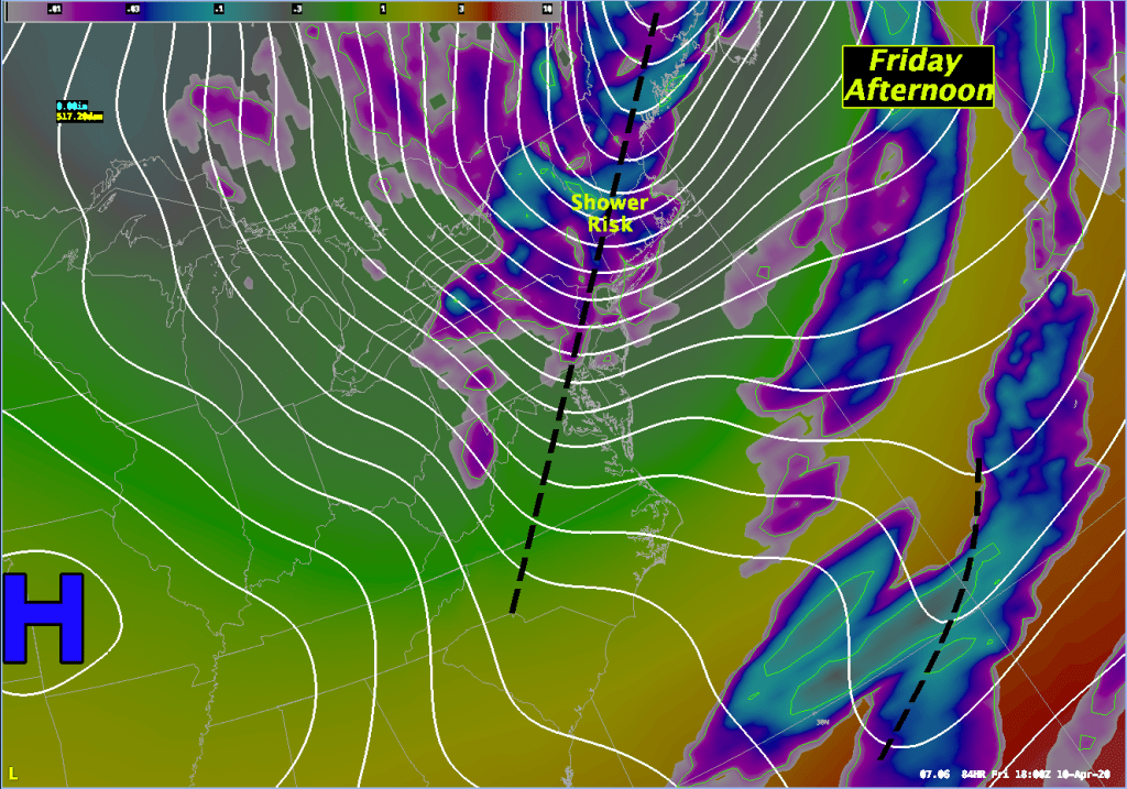
FRIDAY: The front/storm that passes through Thursday will blow up in to a pretty good sized storm to our northeast. This should allow the pressure gradient to remain pretty tight which should lead to another breezy and gusty day on Friday but not quite as windy as Thursday. The upper level low associated with this storm will be parked over Atlantic Canada and spokes of upper level energy will rotate around this low and bring the risk of showers along with them.
SATURDAY: Saturday still looks a bit unsettled but a little less so as the upper low lifts a bit to the north. We will still see spokes of energy whipping around so I still envision some clouds being around with a risk of showers though that risk should be smaller.
SUNDAY: The upper low lifts away completely by Sunday and is replaced by an upper level ridge of high pressure which should completely dry out the atmosphere. It looks like a mostly sunny and mild day. The models are suggesting that some high clouds may slide in during the day as another storm approaches from the SW.
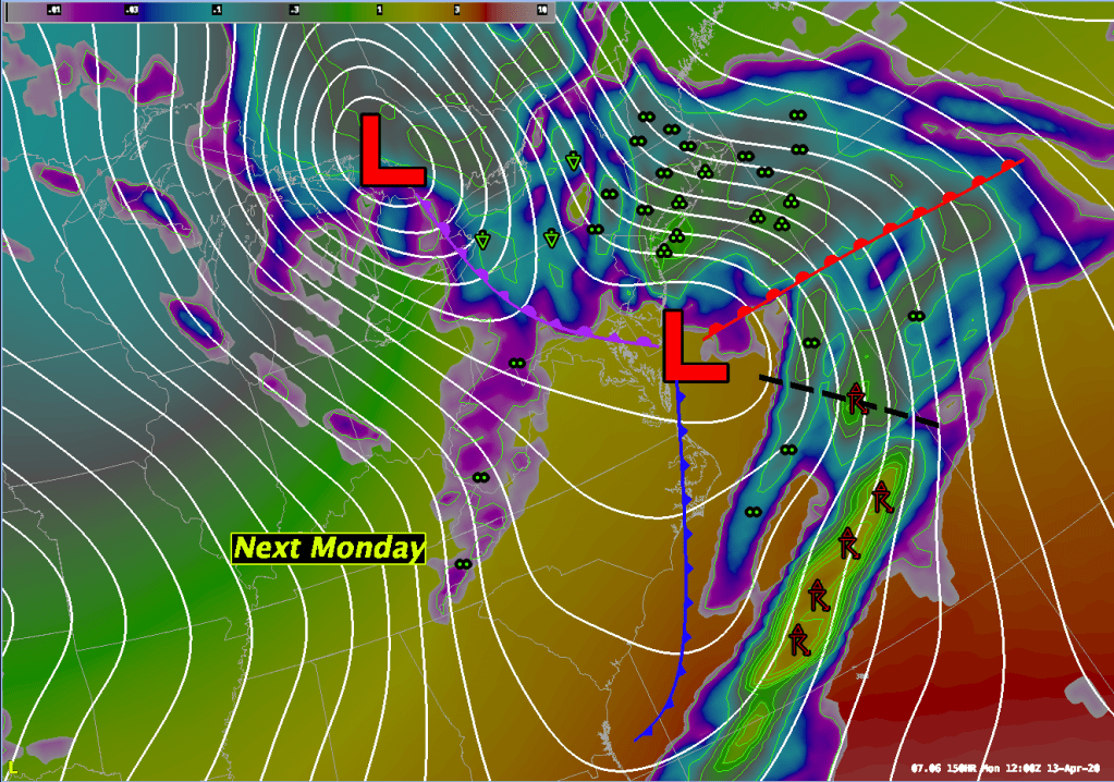
MONDAY: A rapidly deepening low pressure area will move through the Ohio River Valley into the Great Lakes on Monday. A secondary area of low pressure will develop just off the Delaware coast on Monday morning and this should enhance the rainfall potential from this system. We’re still a little too far away from this event to say for sure how much rainfall we will see, but right now, it does look like it could be a soaker.