Issued April 9 2020 – 1:00 pm
FORECAST UPDATE
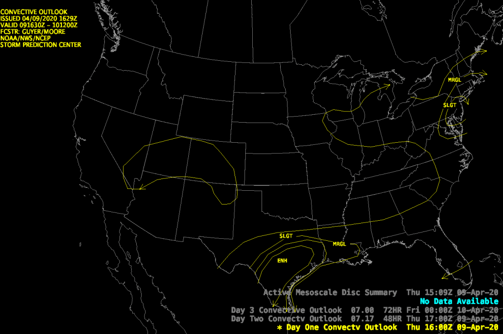
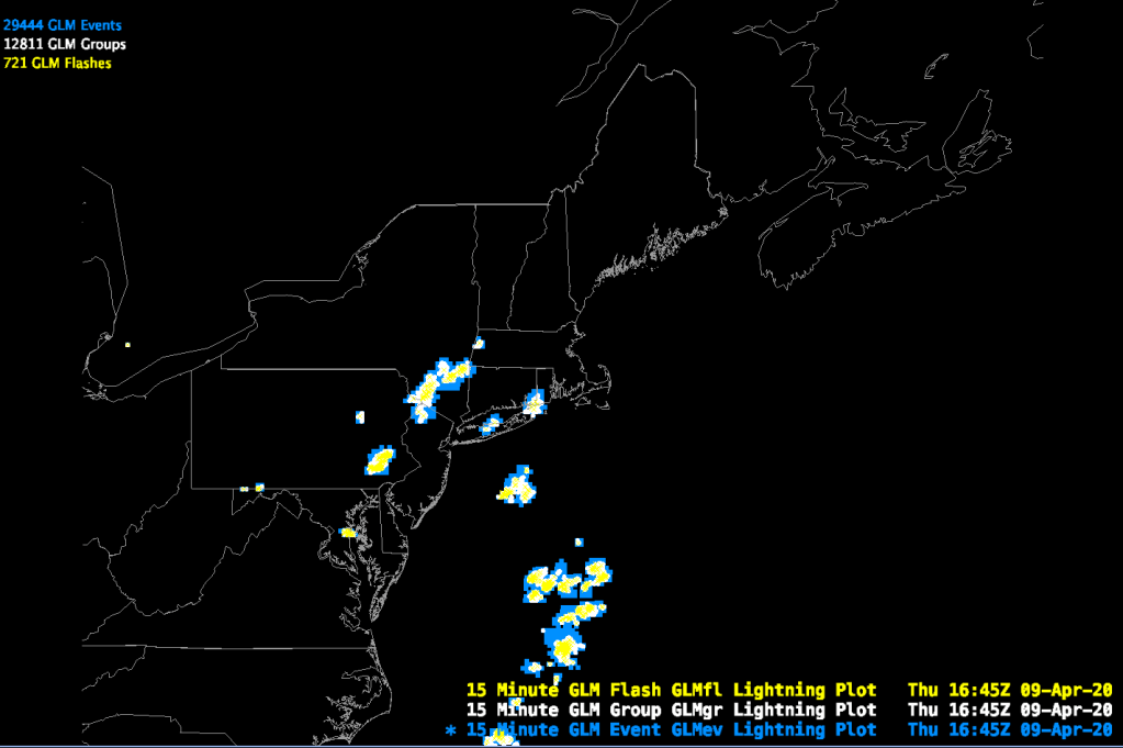

The Storm Prediction Center has issued its 12:30 pm update and they have included Southern New England in the marginal risk area for severe weather. We are seeing some thunderstorm activity, indicated by the lightning detection network, embedded in the larger area of showers that are sliding through our area as indicated earlier. Most of the thunderstorm activity is located in SE NY and eastern PA but there are also some isolated lightning strikes in Long Island sound and southern RI. This is largely confirming my earlier update but, given the SPC’s more aggressive outlook, there could be stronger thunderstorms further north into MA south of the Mass Pike. I still believe that the best chance for thunderstorms remains across southern RI/CT but be on the lookout along and south of a line from Quincy, MA through Worcester, MA this afternoon.
