Issued: April 11, 2020 at 7:20pm
This will be a short discussion this evening as there really aren’t any major changes to the forecast. There are, however, some fairly important notes for Monday.
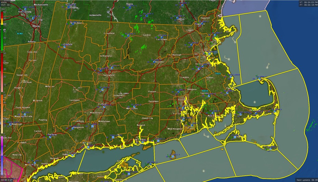
The map below is a map of the watches and warnings issued for Southern New England. The brown outlines which are shown all throughout MA/RI/CT and SE NY are High Wind Watches issued by the National Weather Service which have been hoisted for Monday morning through Monday evening. This high wind watch is being issued as a result of the storm that will impact our area on Monday with a rather heavy slug of rainfall. We are still anticipating at least 1.00″ of rainfall across much of eastern MA from around sunrise on Monday through sunset.
Winds will be rather brisk out of the south across much of SNE with sustained winds 20-35 mph. Wind gusts are forecast to be upwards of 60+ mph in the Boston area and could possibly reach or exceed hurricane force (74 mph) on the Cape and Islands.

Winds will be rather strong on Monday afternoon so travel is not recommended if you can help it. High profile vehicles will be particularly vulnerable to the winds during the time of highest gusts. The strongest winds will move into the Boston area during the late morning and continue into the early evening hours before diminishing overnight.
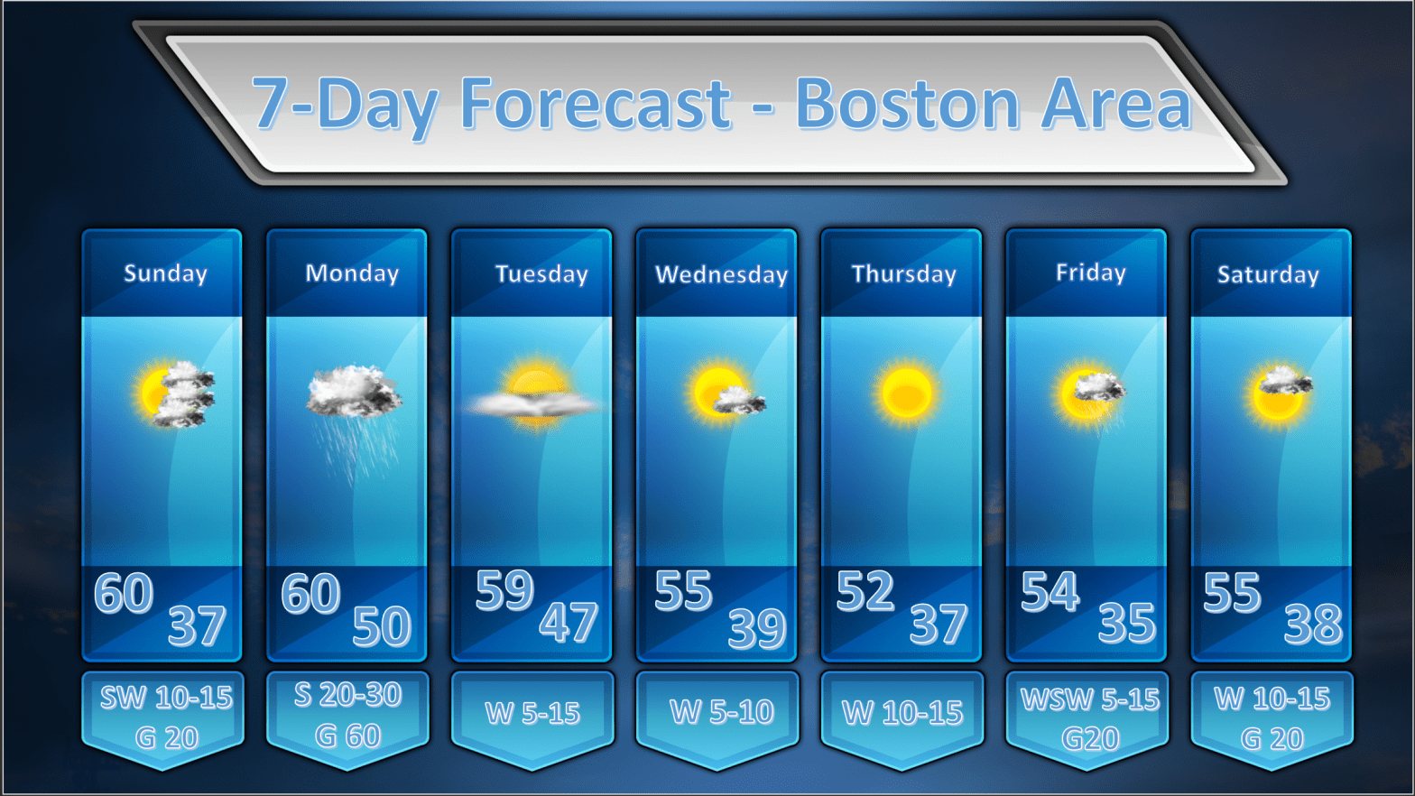
As for the remainder of next week….the weather should be relatively calm and seasonable with temperatures near or just a wee bit above normal.
