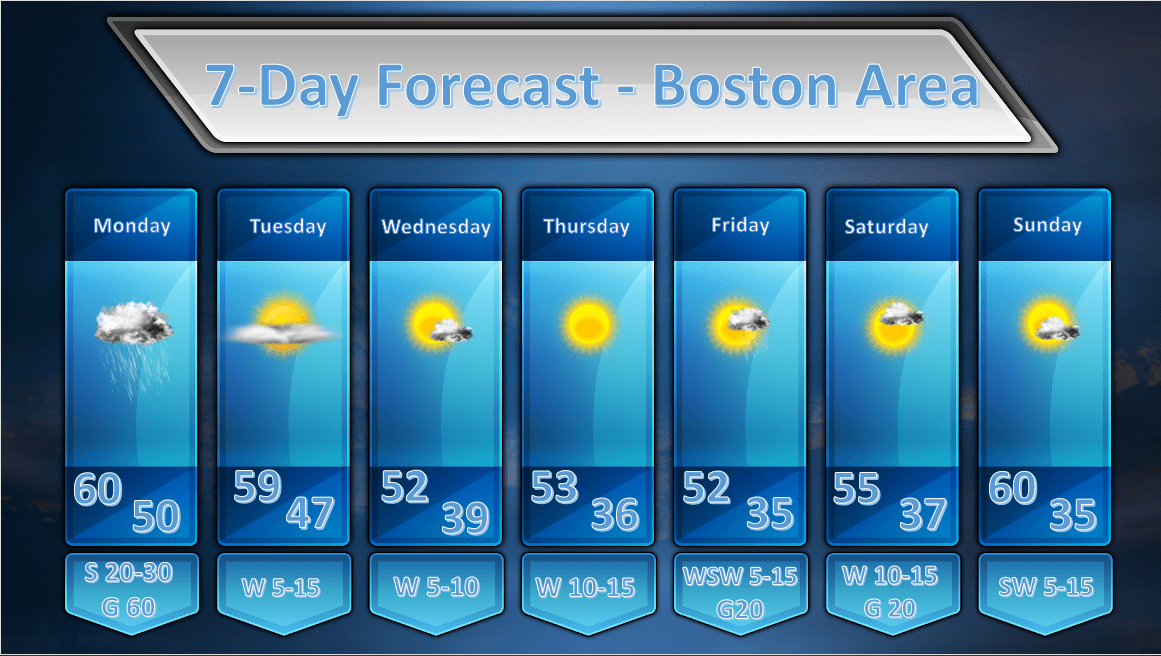
Issued: April 12, 2020 at 9:00pm
The focus of tonight’s discussion will be on the weather event that will move into New England by tomorrow morning.
The major highlights of tomorrow’s weather will be:
- Strong and gusty winds with possible wind gusts in excess of 50 mph in metro Boston and upwards of 70 mph in SE MA/Cape Cod and the Islands.
- Heavy rainfall which will give parts of Southern New England 1.00 – 1.30″ of liquid precipitation. This heavy rainfall will occur in a 12 hour window of time so areas of poor drainage could be prone to flooding.
Strong and Gusty Winds
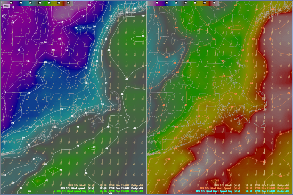
The National Weather Service has issued a High Wind Warning for all of Southern New England for Monday starting around daybreak through 10pm. The earlier start for the warnings will be for the western and central parts of the state and the later start (Noon – 3pm) and end of the warnings will be for eastern and southeastern parts of the state. Wind gusts of up to 60 mph are possible in the Boston Metro area and much of the eastern part of the state. To the southeast on a Quincy, MA to Westerly, RI line gusts of 60-75 mph may be possible especially later in the afternoon/early evening. An increased risk for downed tree limbs, damage to power lines and difficulty driving for high profile vehicles will all be hazards tomorrow. Travel is not recommended and preparations should be made for the possibility of power loss during the afternoon on Monday.
Heavy Rain
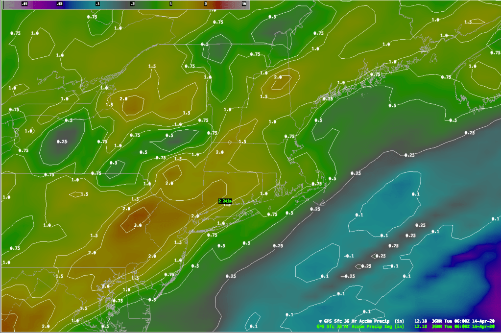
Models are advertising quite a slug of heavy rainfall for all of Southern New England. Generally a soaking of 1.00″ of rainfall will occur over much of the region. The eastern 1/4 of MA, SE NH and Southern RI may see slightly less rainfall but still over 3/4″ of an inch. I do believe that 1″+ is still possible in these areas as well. It appears the jackpot for the heaviest rainfall will be over western MA and CT where upwards of 2″ of rain is forecast. No matter how you cut it, we are going to get really wet.
There is also a chance for a rumble of thunder tomorrow in much of Southern New England as this storm moves eastward over New England. The storm prediction center does have us in their general thunderstorm risk area for tomorrow:
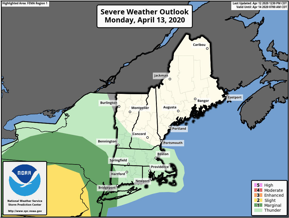
If there is any thunderstorm activity tomorrow it will not be very strong unlike the storms that moved through the Southern United States on Sunday. The heavier downpours associated with these weak thunderstorms will help to mix down some of the higher winds above the surface. 1-2k foot winds will be blowing at 70-80 mph during the afternoon so some percentage of this momentum could be carried down in heavy downpours.
Overall, tomorrow is going to be quite lousy and a really great day to stay home and safe.
