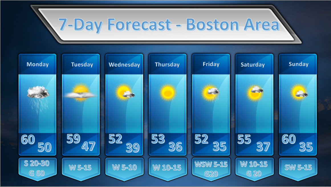
Issued: April 13, 2020 at 12:30 pm
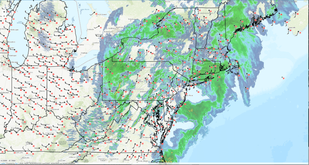
We are starting to see increasing sustained winds and wind gusts across all of southern New England as today’s weather event approaches. The chart above shows all stations reporting wind gusts of 20 mph or more. Generally wind gusts of 25-35 mph are found across much of Massachusetts but there have also been some spots where wind gusts have exceeded 40 mph. Some of the higher gusts that have been reported are:
East Milton, MA. 59 mph (11:51 am)
Worcester, MA 49 mph (11:43 am)
Willimantic, CT 48 mph (11:52 am)
Fall River, MA 48 mph (11:30 am)
Boston, MA. 43 mph (11:54 am)
Westover AFB. 43 mph (11:56 am)
Wind gusts like this should become more widespread this afternoon and there could be higher gusts. Looking at doppler radar velocity scans you can see that wind speeds around 1,400 feet above the ground north of the radar site in Norton, MA are around 70 mph.
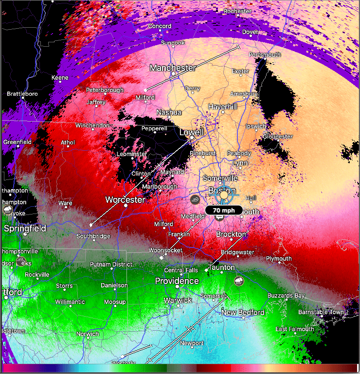
As you go outward from a radar the curvature of the earth causes the radar beam to see returns from higher and higher above the surface of the earth. Using this, we can see what the winds are like above the ground. If there are mechanisms in place to mix the momentum above the ground down to the surface, you can use this as an estimate of gust values. Once the heavier showers and possible thunderstorms move in later today some of this momentum just above the surface of the earth may mix down. If we use 85-95% of the momentum as a rough guess, then the gust potential today should be 60-65 mph at times over in Boston.
Over Cape Cod and the Islands they will be exposed to even higher 1000-2000 ft winds and gust potential there could be as high as 80 mph if these above the surface winds manage to make it to the surface.
Timing: The strong wind gusts will become more widespread between 1 – 3 pm and this should continue until 7-8 pm.
Impacts: Downed power lines, broken tree limbs, downed trees, power outages, and difficulty driving for high profile vehicles will all be potential impacts of today’s storm.
