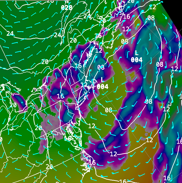
Monday Surface Weather Map…..storm lingering along the coast.
Issued Monday April 27th @ 3:00 am
WEATHER SUMMARY:
….STORM #2 LINGERS, ANOTHER ROUND OF RAIN FOR THURSDAY, THEN SPRING?….
Low pressure southeast of Cape Cod this morning will not move much over the next 12 hours or so and that’s going to lead to a pretty lousy start to the week. A 60 knot low level jet oriented along the coast will continue to feed moisture into this storm system through the day on Monday and that will promote bands of rain to develop on and off throughout the day. In addition, winds will be rather brisk especially along the coast where gusts of up to 40 mph will still be possible. Higher gusts, up to 50 mph may be possible along the Maine coast as the storm deepens.
The low will pull slowly away from the coast by Tuesday and this should promote some drying to take place especially across western New England. In fact, as mid level drying moves NE into CT and W MA I would expect some sun especially later in the afternoon. It will all depend on how much low level moisture hangs on. The models suggest a sharp rise in temperature across that area Tuesday afternoon so I think you’ll have a shot of seeing a little sun at least.
The weather will quiet down a bit for Wednesday but some clouds will move in during the afternoon as a warm front works its way north through the mid-Atlantic states. This warm front could generate a few showers early Thursday as it tries to push through southern New England.
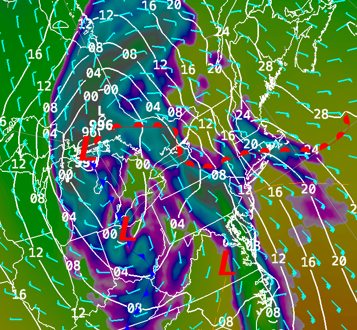
It looks to me like the warm front will stall out in Southern New England somewhere near the MA/CT/RI borders. If this front does make it a bit further north then temperatures on Thursday could end up being quite a bit warmer than currently forecast for the Boston area. As the cold front associated with a storm system moving through the Lower Great Lakes region swings through we will see some heavy shower activity pass through with the risk of a rumble of thunder. The timing on this has been a bit tricky to zone in on but I think late afternoon and evening will be the likely period for these showers to push through.
Upper level low pressure will lag behind on Friday and this will keep our weather on the unsettled side for another day. Things start to change by next weekend as the upper level low pulls away and we establish a westerly flow across the region. It will start to feel more like spring with temperatures in the 60’s and lower 70’s by Saturday and Sunday.
DETAILED FORECAST:
OVERNIGHT: Cloudy with occasional light rain, drizzle and fog overnight. Cloudy and raw. Any left over rain may change to snow across the higher elevations of central VT, central/northern NH and interior ME NW of I-95. 1-2″ of accumulation on grassy surfaces are possible. Winds NE 10-25 gusting to 25-40 overnight strongest winds along the MA east coast, NH Seacoast, and downeast ME. Low temperatures 33-40 degrees. Warmest across southern CT, RI, and Eastern MA. Coldest readings through central New England and Maine.
THIS MORNING: Cloudy with showers and light rain except over far northern New England. It will be breezy and raw. Winds NE to N 10-20 gusting 25-40 mph with highest winds along the coast from Portland to Boston. Temperatures starting off in the low to middle 30’s (coldest across central New England and Maine) rising into the mid to upper 30’s toward afternoon across CT, RI, MA, S. VT, NH and downeast ME. Temperatures across northern ME and NW VT will be rising to 40-45 degrees.
THIS AFTERNOON: Cloudy, cool and raw with periods of light rain for most of New England. Some sunny and dry conditions are likely for far northern Maine around Caribou. NE winds 10-20 mph with gusts 25-40 mph. Highest winds and gusts will be along the immediate coast from Provincetown to Rockland, ME. High Temperatures 40-45 across much of New England except near 50 in NW VT and Northern Maine.
TONIGHT: Showers, drizzle and fog continue overnight across RI/E. MA/NH/SE ME. Drier conditions, but continued cloudy will be likely across CT/VT/N. ME. Winds N 5-15 mph gusting to 20-30 mph mostly in eastern New England. Low temperatures 30-42 warmest MA/CT/RI. 20-30 in northern and western Maine.
TUESDAY: Periods of light rain, drizzle and fog continue across E. MA/RI/NH/Coastal ME. Drying conditions with breaks of sun developing in CT/VT and W. MA especially by afternoon. High 45-50 along the MA E coast 50-55 central MA/NH/VT/ME, near 60 for most of CT and W MA. Winds 5-15 mph with gusts to 20-25 mph over the Cape and Islands. Gusts 20-25 along the NH and ME coasts during the morning..
TUESDAY NIGHT: Drying out with clouds thinning out and clearing overnight. Light and variable winds. Low temperature 35-40 in southern New England. 30-35 central New England. 25-30 across northern VT and NH and interior Maine.
WEDNESDAY: Sunny start with clouds increasing through the day. Winds E 5-10. High temperatures 50-55 along the coast, near 60 inland.
WEDNESDAY NIGHT: Variable cloudiness. Winds E-SE 10-15. Low temperatures 33-38 across ME/NH, 40-45 VT/MA/CT/RI.
THURSDAY: Cloudy morning showers, becoming breezy and mild especially away from the east and south coasts by afternoon, heavy showers and possibly a thunderstorm late day and evening. Highs 50-55 coastal New England into Maine, 60-65 across interior sections.
FRIDAY: Mostly Cloudy with showers likely. High temperature 58-65 north to south.
SATURDAY: Mostly Sunny. Highs 65-70.
SUNDAY: Mostly Sunny. Highs 60-65 across ME, 65-70 for all except SW CT where temperatures should rise into the lower 70’s.
