Issued Tuesday April 28th @ 11:00 pm
WEATHER SUMMARY:
….THIRD TIME IS DEFINITELY NOT A CHARM….
We’ve got one more fairly nice day coming up before our next storm arrives and this 3rd storm is proving itself to be a bit of a forecasting challenge. A ridge of high pressure building in at the the surface and aloft will allow us to fully dry out at all levels through afternoon tomorrow. We should have mostly sunny skies during the morning and early afternoon hours. As a warm front approaches from the SW we will see some high and middle clouds move in over the top of us later in the afternoon. During the overnight hours the front will be trying to push through New England and this may generate a few showers and/or drizzle.
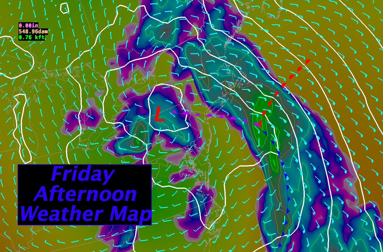
The timing of the approach of our next weather system has changed a bit since my last forecast as the models have been fluctuating with the speed of the next systems approach. As a result, it looks like the steady heavier rain from the next system will take a bit longer to get in here. The storm system on all of the computer models is intensifying rapidly as it approaches the east coast and this intensification process is tending to slow the eastward progress of the system at large. As a result we won’t see the bulk of the rain from this storm until Friday morning/afternoon. It should be a pretty good soaking, however, as the models generally agree on .50-1.20″ of rain for much of New England.
Once this system moves fully on by we should have a stretch of 3-4 fairly nice days with fairly calm weather and springtime temperatures.
DETAILED FORECAST:
OVERNIGHT: Variable cloudiness throughout New England. Light and variable winds. Low temperatures 35-40 from S. CT through RI, into Metro Boston, northward along the NH and ME coast. 25-30 west of 495 through central and western MA/S. and Central VT, NH and SE Maine away from the coast. 18-25 NH White Mountain and ME Blue and Boundary Mountain regions.
WEDNESDAY MORNING: Partly to mostly sunny. Temperatures 40-48. E winds across SNE 5-10. NE winds 5-15 across Maine.
WEDNESDAY AFTERNOON: Partly sunny with increasing clouds after 2pm. Winds SE 5-10 gusting 15-20 mph. High temperatures near 50 along the coast mid 50’s just inland from the coastal plain, 60-65 interior New England.
WEDNESDAY NIGHT: Mostly Cloudy Winds E-SE 10-15 with 20-30 mph gusts from central/western CT, western MA and VT. Low temperatures 30-35 interior Maine, 35-40 for central and northern NH/VT, 40-45 southern NH/VT/MA/CT/RI
THURSDAY: Overcast with a few showers possible. Highs 52-60 southern New England through western VT. NH/SW ME 45-52
THURSDAY NIGHT: Cloudy with spotty showers, especially to the north. Winds SE 10-20 mph. Lighter winds over interior Maine. Gusts 30-40 mph along the New England south coast, 25-35 mph across most of MA, up the Green Mountians, and along the Maine coast. Low temperatures 35-40 across ME/N. NH. 40-45 S ME/VT. 45-50 MA/RI/CT.
FRIDAY: Rain overspreading New England starting around sunrise in SW CT, spreading into the Boston, MA to Concord, NH to Burlington, VT areas by 7-9am and into SW Maine by 12pm-2pm. Rain heavy at times. .75 – 1.25″ possible. SE winds 5-15 mph over CT/W MA/NH/ and interior ME. SE winds 15-25 mph along the MA/RI/ME coastline. SE winds 25-30 mph over Cape Cod. Gusts 25-40 RI/E MA/SE ME. Gusts 40-60 mph on the Cape. Highest winds during the morning hours. High Temperatures 55-60 south and east facing coastal areas. 60-65 inland.
FRIDAY NIGHT: Rain tapering off and ending toward evening just about everywhere. Remaining mostly cloudy. Winds light and variable. Lows 45-50.
SATURDAY: Mostly Sunny. Highs 55-60 in northern ME, 60-65 across central and southern ME/N NH/N VT, 65-70 for the rest of the region.
SUNDAY: Mostly Sunny. Highs 60-65 throughout ME, 65-70 VT/NH/MA/RI, 70-75 in CT.
MONDAY:Mostly Sunny. 65-70 for southern New England, 62-67 across central New England, 60-65 N NH/VT, 55-60 Central and Northern Maine.
TUESDAY: Mostly sunny start, with some clouds moving in by afternoon. High temperatures in the mid 50-‘s north, low 60’s throughout SNE.
