…Ah! A beautiful morning! Trouble lurking for Thur/Fri….
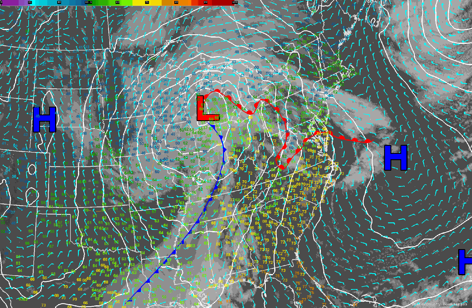
We’ve got a fantastic day on tap as high pressure is in control of our weather for now. A storm system tracking through the Upper Great Lakes this morning will figure prominently in our weather during the next 48 hours or so. This storm will begin to impact our area tomorrow as the warm front associated with this low makes an attempt to push northward into New England. The front will be slowed by the colder air dammed in near the surface over interior New England. Ultimately this will lead to quite a bit of cloudiness developing overnight tonight into tomorrow for much of New England and the risk of some shower activity as well.
As the storm progresses toward the coastline on Thursday night, clouds will lower and thicken and rain will break out throughout New England. Rain will start in the wee hours of Friday morning in the western part of the region and then advance to involve all of New England in the wet weather by afternoon.
After Friday afternoon there is some uncertainty in the forecast. The GFS is the odd man out in this argument between the different models with a more progressive system by Saturday which clears out the storm quickly. The NAM and European model are tending to form a deeper and slower storm and there is pretty good agreement between those two models. The upshot that is that we will have clouds and maybe a few showers lingering into Saturday morning before we clear out. That, unfortunately, will probably result in slightly cooler temperatures in the forecast before we hit a pretty good warming trend for Sunday into early next week.
