Issued Friday May 15 2020 7:55pm
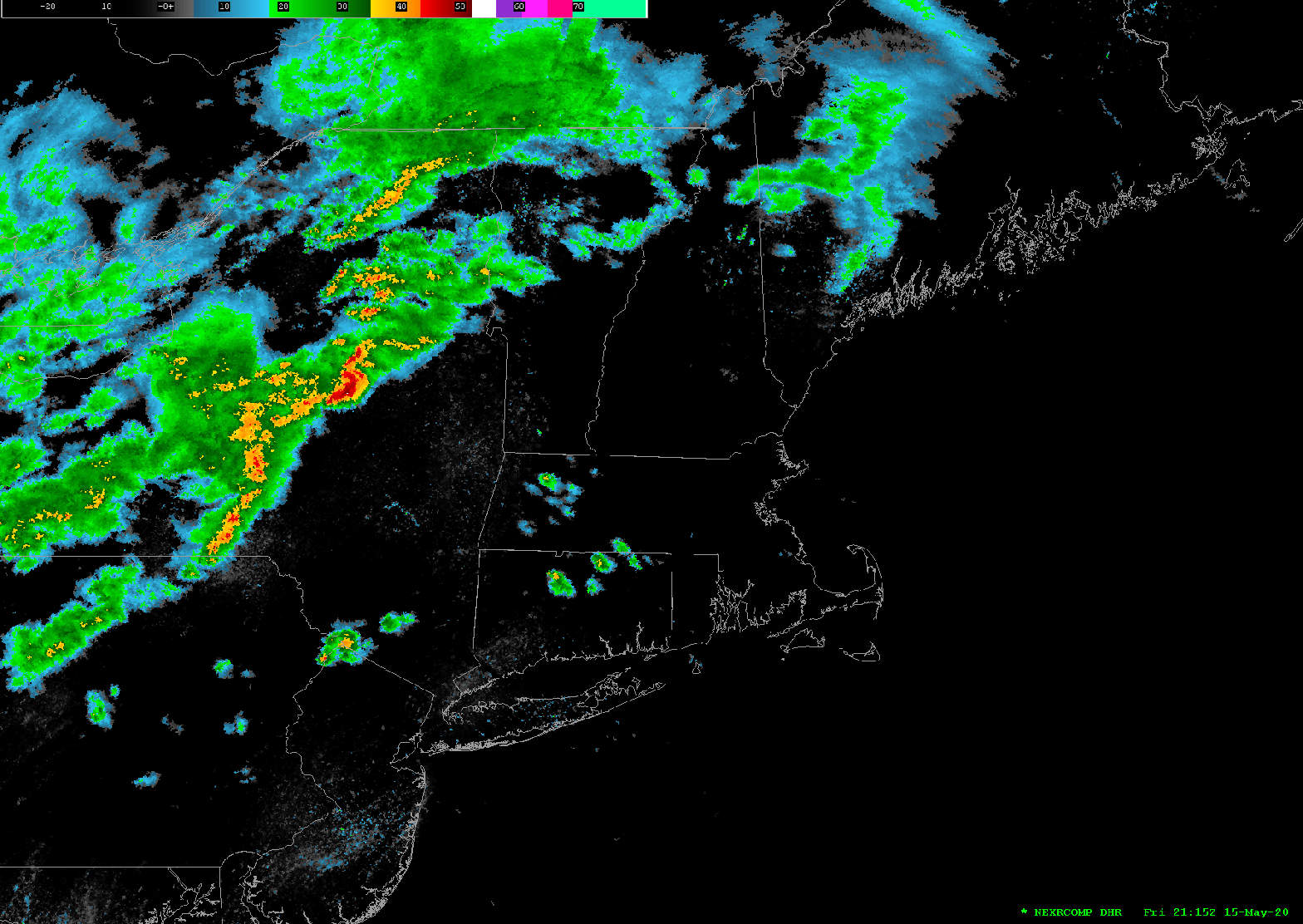
A line of strong showers and thunderstorms are pushing through central and western MA and SW and central NH as of 7:45pm this evening. This line of thunderstorms may contain cells which may generate damaging winds, hail, frequent lightning and the potential for small isolated tornadoes. The National Weather Service also has most of Massachusetts under a Tornado Watch until 10pm this evening. This line of thunderstorms should arrive in the Worcester area around 8:30 pm, into the western and northern suburbs of Boston by around 9:00pm, into the Boston area itself by 9:15pm and to the Cape Cod Canal by 10:00pm.
Particular attention should be paid to the skies if you are outdoors as this line of thunderstorms approaches your area. Lightning detection is showing quite a bit of strike activity associated with these storms as they approach and radar indicates some bowing of the radar returns. This indicates the potential for strong damaging winds. No reports of Tornadoes have been received and we don’t see any indication of hook echos at this time.
