Issued Friday May 15 2020 9:15 pm
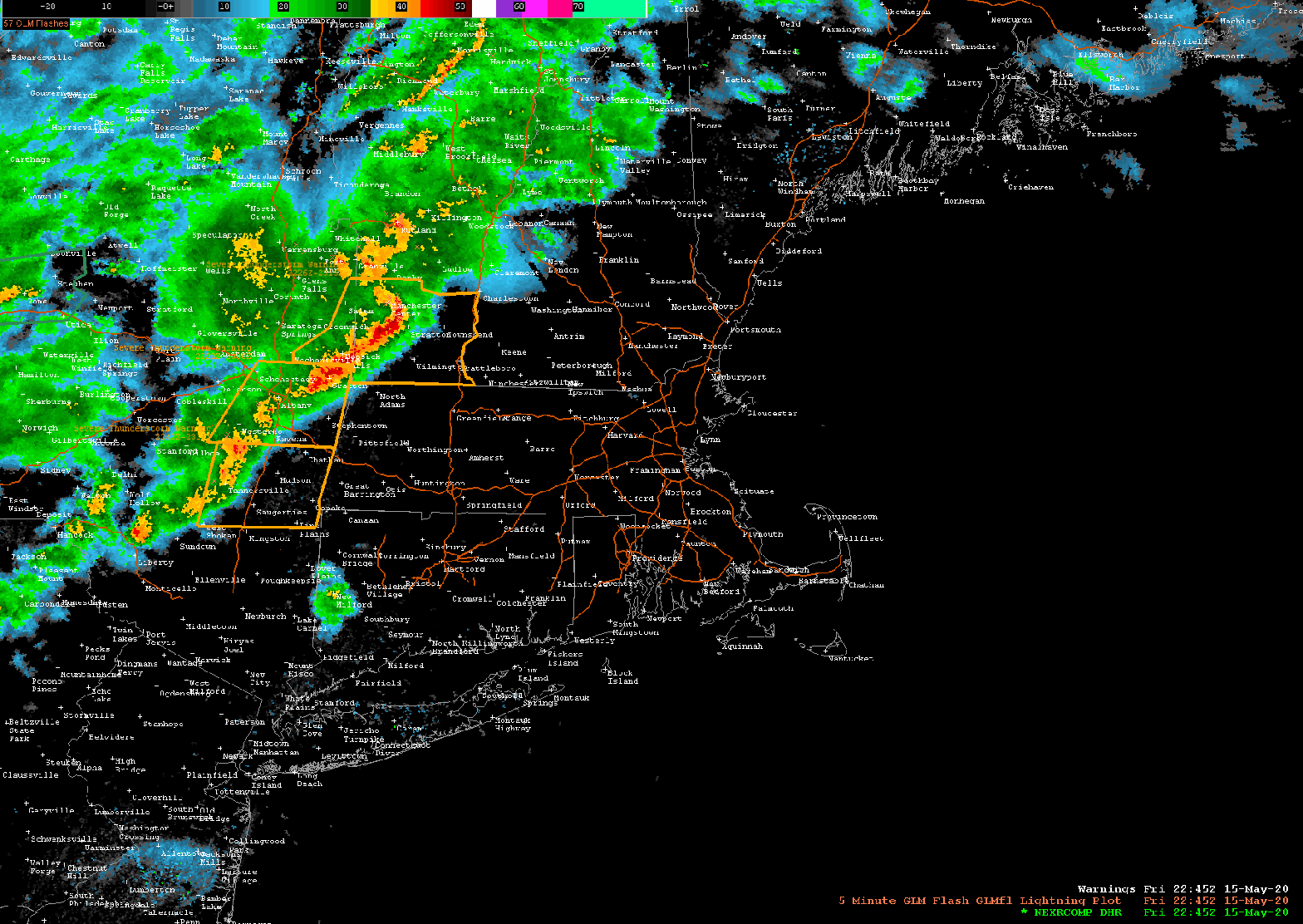
The line of showers and thunderstorms we’ve been monitoring tonight has made its way through most of Massachusetts and is now pressing toward the SE into the Providence, Brockton, Taunton, and Plymouth area. The storms did weaken significantly in Eastern MA once they got inside of 495. This is likely due to the more stable atmosphere closer to the coastline. These storms still had rather gusty winds and heavy downpours. There are still a few stronger cells further west in the Oxford/Milford/Woosocket, RI area as well as in central CT. These storms are pressing toward the east at 50 mph or better.
As the storms approach the southern portions of CT, RI and the Cape Cod canal the tendency should be for these storms to continue to weaken due to a more stable air mass in those areas. Still, you will see gusty winds, heavy downpours, and thunder and lightning.
