Issued: Friday May 15 2020 3:00 pm
…SEVERE WEATHER POSSIBLE THIS EVENING….
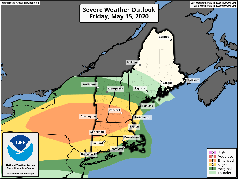
The Storm Prediction Center has placed all but SE CT/Southern RI/and SE MA in either the Slight or Enhanced risk category for severe weather today.

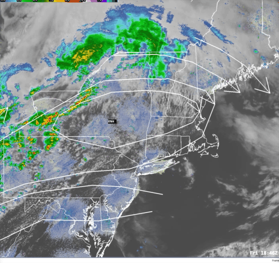
Based on current data thunderstorms are blossoming in western New York state and northern Pennsylvania. This is in advance of a frontal system pushing into the Lower Great Lakes region. In New England we have a very balmy day in progress across much of the state. Temperatures have risen into the middle to upper 70’s everywhere with the exception of Logan Airport, which is currently reporting 68 degrees with a SE wind, and the SE coast of CT, coastal RI, and Cape Cod where temps are in the mid 60’s to around 70 due to the onshore SW wind. The air is also fairly muggy relative to the time of year with dewpoints in the mid 50’s to around 60.
All of these ingredients (warm temps, humid air, and instability) will conspire to hold together the line of thunderstorms running through NY right now. These storms could contain strong damaging winds, hail, frequent lighting and the possibility of a weak tornado, especially in the northern and western sections of MA. I expect these storms to pass through SNE starting around 5-7 pm in NW MA and then advancing into central MA and the Boston area by 7-9 pm. If the storms hold together past the Boston/Worcester area cities like Brockton, Providence and New London may see these storms between 9-11 pm.
