URGENT - IMMEDIATE BROADCAST REQUESTED
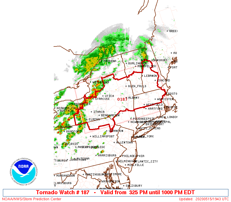
Tornado Watch Number 187
NWS Storm Prediction Center Norman OK
325 PM EDT Fri May 15 2020
The NWS Storm Prediction Center has issued a
* Tornado Watch for portions of
western and central Massachusetts
southern New Hampshire
central through eastern New York
northeast Pennsylvania
southern Vermont
* Effective this Friday afternoon and evening from 325 PM until
1000 PM EDT.
* Primary threats include...
A couple tornadoes possible
Widespread damaging wind gusts to 70 mph likely
Scattered large hail events to 1.5 inches in diameter possible
SUMMARY...Storms with a few bowing segments and possible supercell
structures are expected to develop through New York and southern New
England this afternoon and early evening. Damaging wind appears
likely with a couple of tornadoes possible.
The tornado watch area is approximately along and 90 statute miles
north and south of a line from 45 miles north northwest of Elmira NY
to 30 miles southeast of Concord NH. For a complete depiction of the
watch see the associated watch outline update (WOUS64 KWNS WOU7).
PRECAUTIONARY/PREPAREDNESS ACTIONS...
REMEMBER...A Tornado Watch means conditions are favorable for
tornadoes and severe thunderstorms in and close to the watch
area. Persons in these areas should be on the lookout for
threatening weather conditions and listen for later statements
and possible warnings.
&&
OTHER WATCH INFORMATION...CONTINUE...WW 186...
AVIATION...Tornadoes and a few severe thunderstorms with hail
surface and aloft to 1.5 inches. Extreme turbulence and surface wind
gusts to 60 knots. A few cumulonimbi with maximum tops to 500. Mean
storm motion vector 27035.
...Dial