Issued Saturday May 16, 2020 3:00pm
WEATHER SUMMARY:
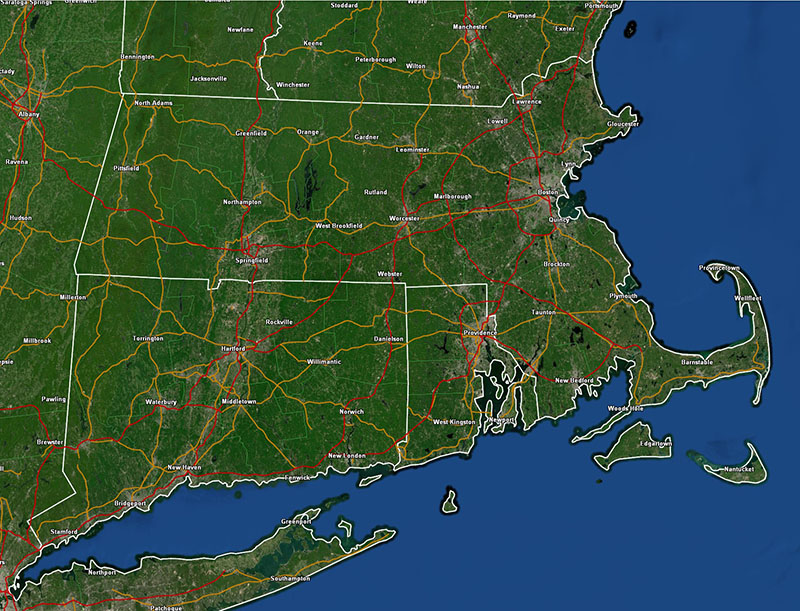
After the severe weather that passed through New England last night, today is a welcome weather treat! Comfortable temperatures and a fresh breeze make today a beautiful day to be outdoors here in the middle of May. I’m pleased to say that the weather will be just as good tomorrow as high pressure maintains control of our weather.
Things will go a bit downhill by Monday as some overrunning in advance of a frontal boundary kicks in and throws a canopy of clouds over us. Those clouds will largely be with us for the balance of the day on Monday and there COULD be the slight risk of a shower or two over the Berkshires Sunday night into Monday, but I think this front will be mostly dry.
The forecast gets a bit tricky from the 2nd half of Monday into the middle part of the week. There are three weather features that are coming together to complicate the forecast. The first feature is an upper level shortwave moving through the northern plains which will team up with the 2nd feature over northeast Texas to form a very impressive upper level low in the eastern 1/2 of the United States by Tuesday night into Wednesday.

The third feature, the wildcard, is a low pressure system off the Florida east coast that is looking very tropical. In fact, this disturbance looks like it may become the first named Atlantic tropical storm of the season. If it is named it will be named “Arthur”. The biggest question with this tropical disturbance isn’t whether or not it will become a hurricane. That seems very unlikely. The big question will be just how much does the disturbance interact with the developing east coast low pressure complex and how much of its tropical moisture gets pulled into this developing mid-latitude cyclone.
Looking over the models you have two camps (what else is new). One camp draws the disturbance’s moisture along the east coast and may cause significant rainfall from the Carolinas up to SE New England. This is the solution favored by the 12Z GFS. The 00Z ECMWF and 12Z NAM40 paint a different picture with the disturbance remaining separated from the mid-latitude cyclone and not injecting its moisture and energy into it.
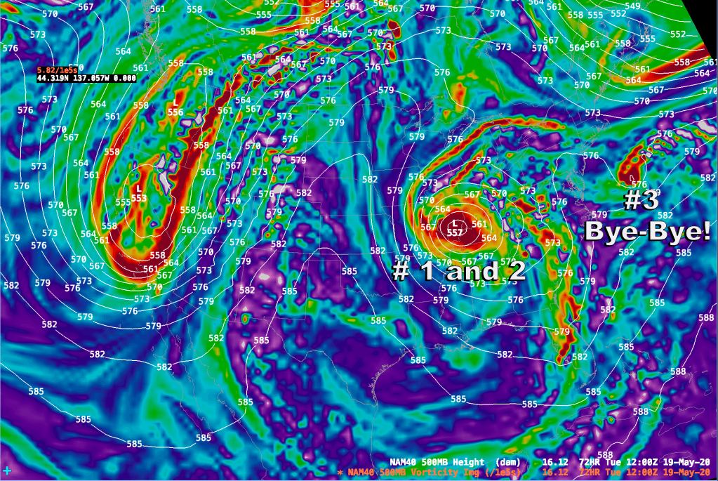
I believe that the key, ulitimately, to how this will play out is a dome of cold high pressure that will drift SE over Maine from Monday – Wednesday. This high will force a back door cold front through southern New England Monday night into Tuesday. This push of low level cold air into New England should act as a blocker to the northward surging tropical system. This leads me to agree with the ECMWF/NAM backed solution which basically slides the tropical system eastward and out to sea once it gets north of 36 deg N latitude.
The upshot of all of this is that we should be spared a rather heavy rain event on Tuesday into Wednesday. The weather should be pleasant albeit a bit on the cool side for this time of year due to a very persistent NE wind.
THIS AFTERNOON: Partly Sunny and warm. Winds NW 12-18 mph G 20-25 turning E toward evening. Highs 68-73.
TONIGHT/OVERNIGHT: Clear and cool. Winds E-NE 5-10. Lows 45-50.
SUNDAY: Mostly sunny. Winds S 5-15 mph. Highs 60-65 along the east and south coasts and in the Berks. 65-70 interior MA east of the mountians.
SUNDAY NIGHT: Clear to start, increasing clouds after midnight, risk of showers over western MA. Winds light and variable. Low temperatures 50-57.
MONDAY: Mostly cloudy, risk of a shower. Winds E 10-20 mph (highest along the E coast). High temperatures 52-60 along the east facing coast, 60-65 inland.
MONDAY NIGHT: Becoming mostly clear and chilly. Winds becoming NE 10-15 mph. Low temperatures around 40 in Boston rising to around 50 at the SW CT/NY border.
TUESDAY: Partly Cloudy. Winds NE 10-20 mph. Highs near 50 along the east facing coast. Mid 50’s to around 60 over the interior.
TUESDAY NIGHT: Mostly clear. Winds NE 5-15 mph. Lows 42-47.
WEDNESDAY: Mostly Sunny. High Temperatures near 50 along the coast, mid 50’s to lower 60’s inland.
THURSDAY: Partly Sunny. Highs near 60 at the coast. 65-70 inland.
FRIDAY: Partly Sunny. Highs 65-70 at the coast. 70-75 inland.
