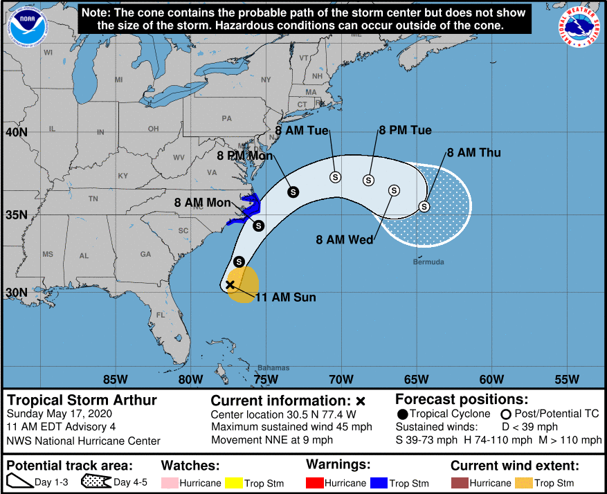
At 11pm last night the National Hurricane Center named Tropical Depression #1 “Arthur”. The current position fix of Tropical Storm Arthur is:
SUMMARY OF 1100 AM EDT…1500 UTC…INFORMATION
LOCATION…30.5N 77.4W
ABOUT 345 MI…550 KM SSW OF CAPE HATTERAS NORTH CAROLINA
MAXIMUM SUSTAINED WINDS…45 MPH…75 KM/H
PRESENT MOVEMENT…NNE OR 15 DEGREES AT 9 MPH…15 KM/H
MINIMUM CENTRAL PRESSURE…1002 MB…29.59 INCHES
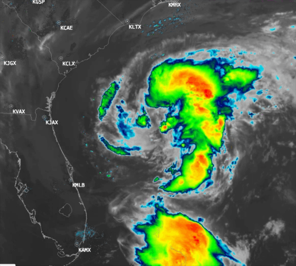
On satellite Arthur’s presentation is a bit ragged with very little deep convection near the center. There is, however, a well defined low level circulation. Arthur’s convection should pep up a little later today with the heating of the sun, favorable SST’s and relatively low wind shear. Satellite imagery shows decent outflow in the northern, western, and southern quadrants of the storm. There may be a little bit of SW shear staunching the outflow to the east of the storm center. On the whole, I don’t expect Arthur to strengthen much if at all over the next 24 hours.
Arthur’s track will take him to just off Cape Hatteras, NC by tomorrow morning and then he will take a sharp right turn passing harmlessly out into the Atlantic by Tuesday morning.