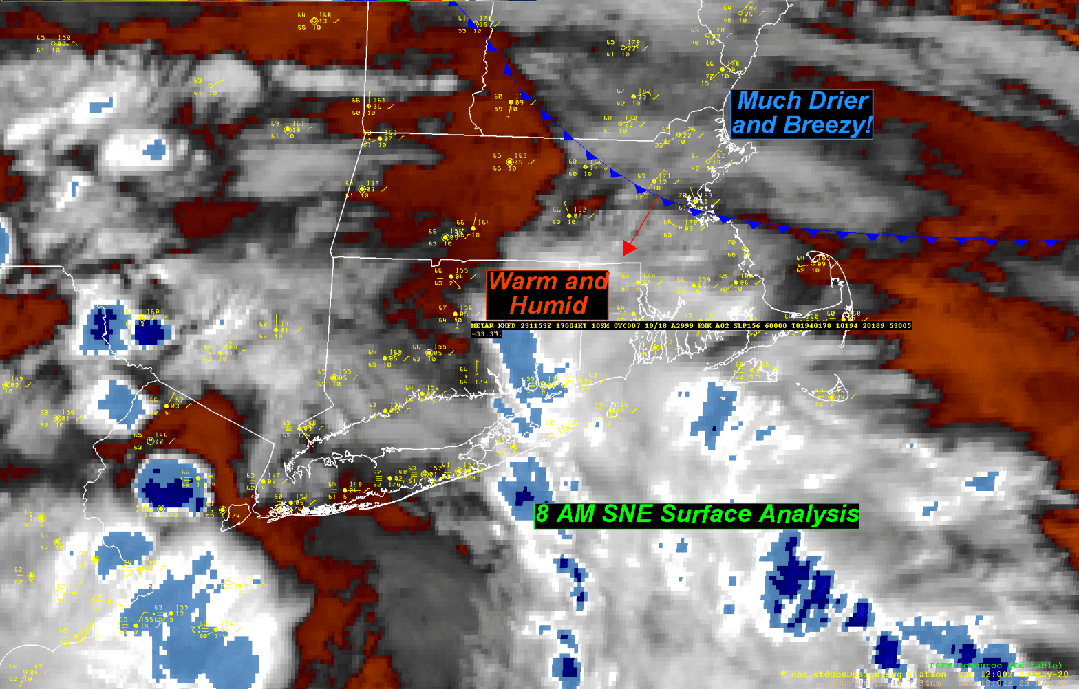
The back door cold front that will bring much cooler and drier conditions to SNE by this afternoon looks to be making its transit through SNE as we speak. At 8am the front appears to have passed through Boston proper, all of Essex county and the eastern portion of Middlesex county. The front will continue its march off to the SW during the day today fully penetrating all of SNE by this evening. Temperatures are going to begin to fall dramatically by later this morning into the afternoon plunging from current levels (upper 60’s to low 70’s at this time) into the mid and upper 50’s by 2pm. The change that accompanies the passage of the back door cold front will be abrupt with a sudden wind shift into the NE with gusty winds of around 20 mph.
We’ve managed to hit the highest temperature we’re going to see for the day today. Warmer weather will return by the middle of next week.
