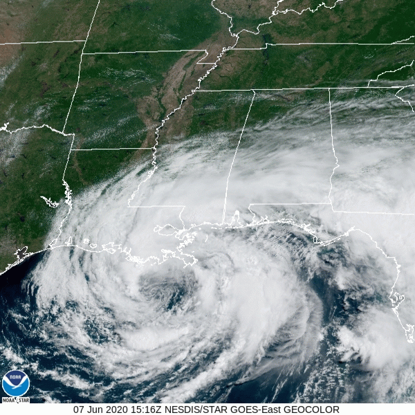
As of 1 pm today Tropical Storm Cristobal was located 30 nautical miles S-SE of Grand Isle, LA and 90 mi south of New Orleans, LA. Cristobal remained at a fairly steady state overnight and this morning with maximum sustained winds of 50 mph. Cristobal is moving toward the north at 5 mph.
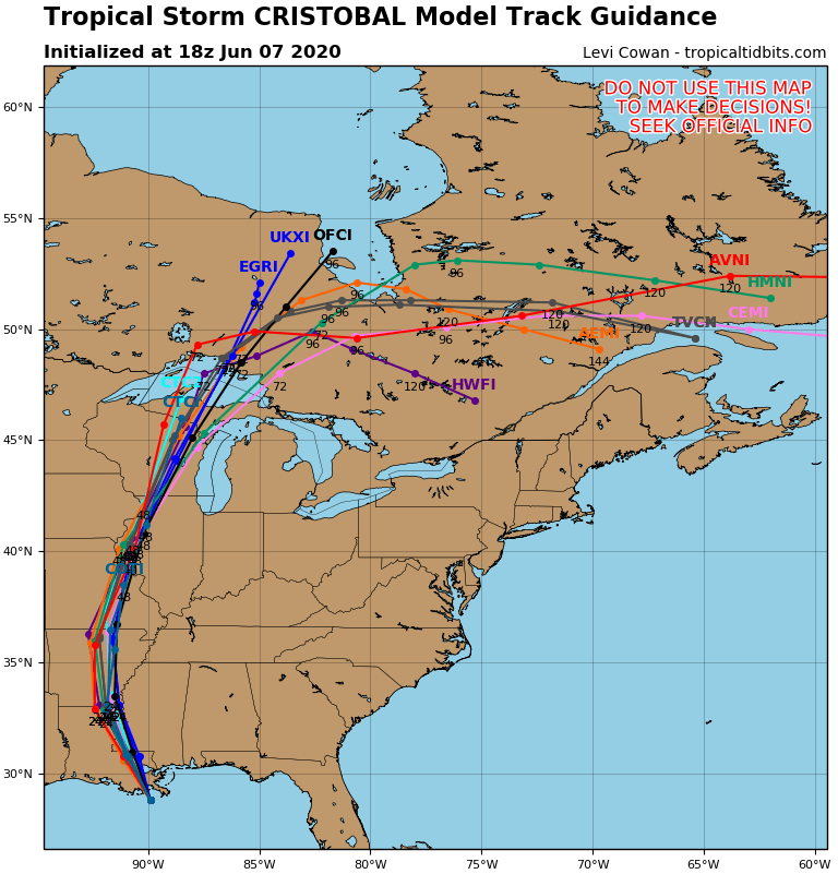
Cristobal should continue to move slowly toward the north or northwest for the next several hours heading for a landfall along the LA coastline sometime between 7pm and 9pm this evening. After landfall Cristobal will continue to move toward the NNW near New Orleans and then up into AR by Monday evening.
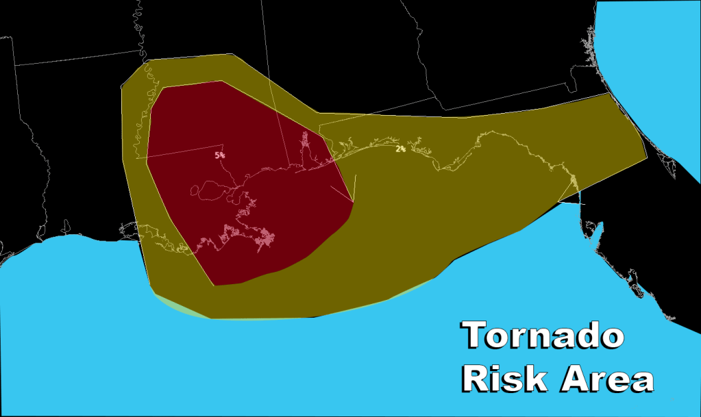
The main effects of Cristobal will be storm surge, heavy rain, and weak spin up tornadoes.
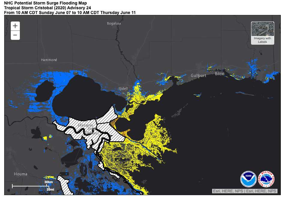
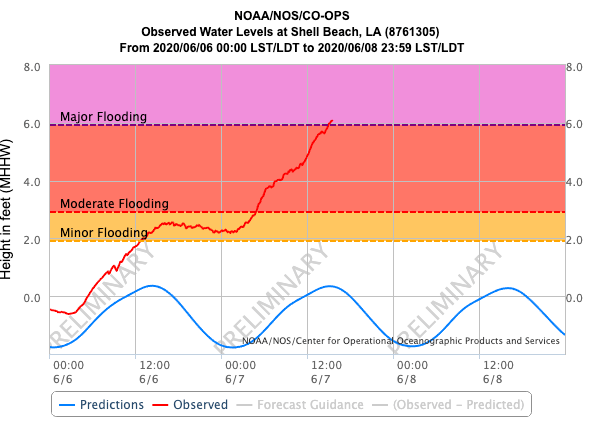
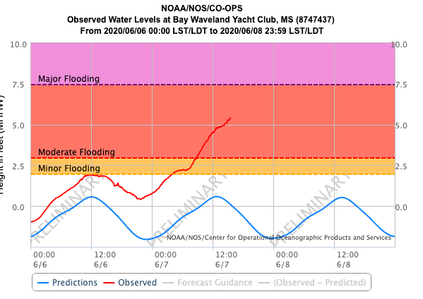
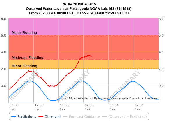
The storm surge forecast hasn’t changed very much since last night with the focus of the storm surge continuing to be from the mouth of the Mississippi River to Ocean Springs, MS.
Some minor to moderate storm surge flooding is occuring at some stations along the LA and MS coasts. The worst station appears to be Shell Beach LA with a nearly 6′ storm surge occuring and the potential for major flooding in the area.
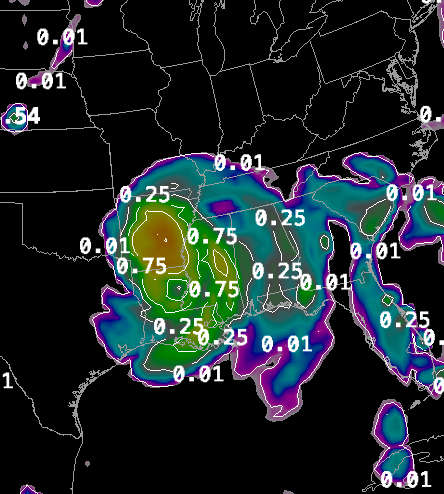
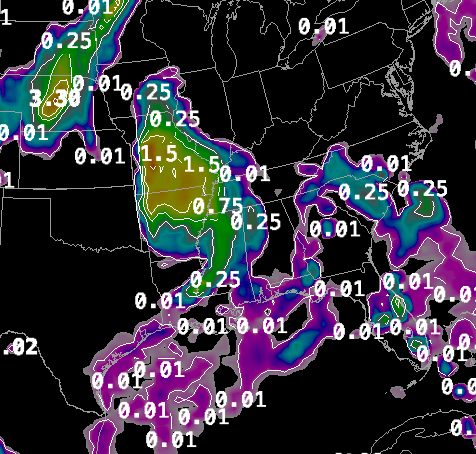
Rainfall has also been a significant factor with this storm. Very heavy rainfall occured yesterday in northern Florida with 5-10″ of rain being generated by band after band of heavy showers.
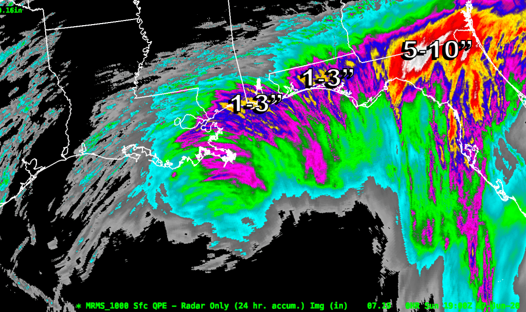
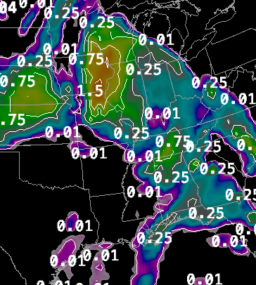
The next major threat area for heavy rain will be between New Orleans and the FL/AL border where there have been 1-3″ of rainfall thus far. Another 4-5″ of rainfall may fall in that area between now and Monday morning.
The inland threat of heavy precipitation is also still very much in play with heavy rainfall predicted for the central US from LA northward to WI.
Wind is a factor with this storm but not as significant when compared to the rainfall and storm surge flooding. Cristobal is throwing 35-45 mph winds up toward the LA and MS coast line and there are gusts of up to 55 mph as the stronger showers or thunderstorms pinwheel in from the Gulf. Thankfully, Cristobal does not have very destructive winds associated with it.
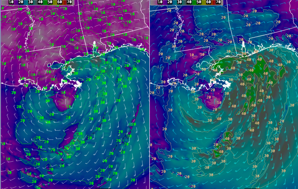
Tornado activity is also still a problem as Cristobal approaches the Louisiana coastline. Waterspouts and tornadoes have been reported along the Gulf Coast and in Florida today. The focus of the tornado potential will be in eastern LA and southern MS and along the Gulf Coast to north central FL.
We will continue to follow Cristobal as it makes landfall.
