
Forecast Issued: Sunday, December 15, 2024 8:32 pm
Overnight: Increasing Clouds with light winds . Temperatures near freezing in the city 25-30 in the burbs.
Monday Morning: Cloudy with winds light and variable becoming E-SE 5-10 mph but light and variable over western sections of SNE. Temperatures ranging from 30-35 near Boston down to 25-30 N & W of 495.
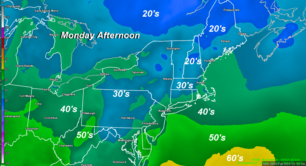
Monday Afternoon: Mostly cloudy with temperatures rising into the low 40’s over most of eastern MA/RI/E CT but holding in the mid 30’s across northern Worcester county and in the Berkshires. Winds continuing light and variable west of Worcester/Hartford up into Southern NH/VT. SE 10-15 mph over eastern and southeastern parts of the area.
Monday Evening: Mostly Cloudy with the risk of a shower or two early and then light rain develops overnight. Temperatures holding steady or rising through the 40’s especially overnight and toward sunrise. Winds increasing to SE 10-15 mph in western sections with higher gusts in the hilly terrain of Worcester County and northern CT overnight. Becoming more brisk out of the southeast over eastern and SE sections of MA especially over Cape Cod and the islands 10-20 mph gusting to 25-35 especially along the coast.
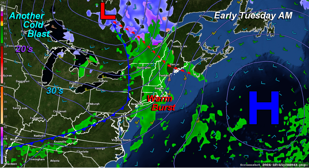
Tuesday: Light rain through the early morning hours which should end shortly after sunrise. Low temperatures near 40 in the city 35-40 in the burbs and western sections. High temperatures will reach into the upper 50’s during Tuesday afternoon. Winds turning S-SW 5-15 gusting to 20-40 especially along the coast.
Wednesday: Filtered sunshine early giving way to increasing clouds by afternoon. Overcast by evening with rain developing. High temperatures near 50 degrees.
