Issued Sunday, December 15, 2024, @ 10:10 PM
Friday (12/20): Partly cloudy and cold with the chance of a snow shower. Highs near 30 east, middle 20s west/north.
Saturday (12/21): Partly to mostly cloudy, especially for SE MA and Cape Cod; risk of snow showers along the coastline, especially the Cape and Islands. Highs 25-30
Sunday (12/22): Partly sunny and breezy. Highs 22-27
Monday (12/23): Mostly sunny. Highs 22-27 throughout much of MA / 25-30 Cape Cod and CT/RI.
Tuesday (12/24): Cloudy with the risk of a rain or snow shower. Warmer with highs in the mid to upper 30s.
Wednesday (12/25): Cloudy, risk of a shower. Highs near 40.
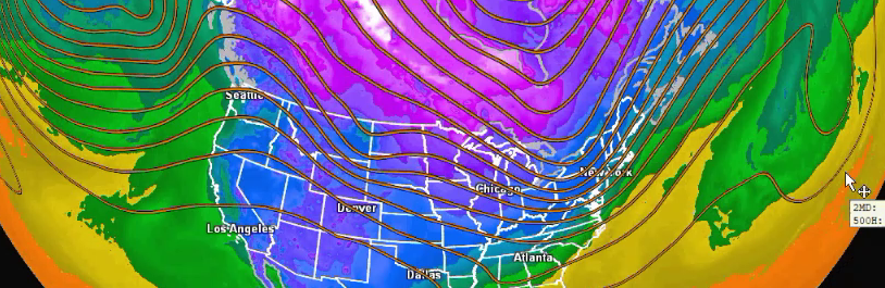
Long Range Outlook:
Upper-level ridging is expected to develop along the east coast after Christmas Day, which should promote a continuation of the warming trend that starts on Christmas Eve. The vacation week between Christmas and New Year’s should feature above-average temperatures for this time of year, ranging from the 40s into the 50s. We could even see temperatures near 60 during this time, especially during or around the weekend before New Year’s Eve/Day.
