***NEW FEATURE! You can get these forecasts and blog entries delivered directly to your e-mail. Click the button at the bottom of this post to subscribe!*** Issued Wednesday May 20 2020 11:30 pm WEATHER SUMMARY: As we pass through mid week the weather story is looking a bit warmer during the next 48 hours asContinue reading “Southern New England Forecast”
Author Archives: Brian Treanor
Hey! Wasn’t it supposed to warm up?!
Issued Tuesday May 19 2020 12:00pm I can hear you out there now. Where is the %^&^$^%( warm weather! Patience young Jedi….warm weather is on the way though it is delayed a little bit. A few forecast posts ago I spoke about the pattern change that we were looking at in the long term. IContinue reading “Hey! Wasn’t it supposed to warm up?!”
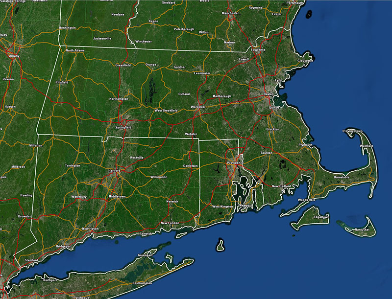
Southern New England Forecast
Issued Monday May 18, 2020 5:30pm WEATHER SUMMARY: Looking at the weather map this afternoon there isn’t too much on it of any concern. The devil, however, is always in the details. High pressure over southern Canada is pressing toward the southeast and will eventually push a backdoor cold front, now draped across central NewContinue reading “Southern New England Forecast”
Special Forecast Update
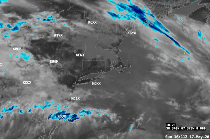
Issued: Sunday May 17 2020 12:15 pm When people ask me why I’ve lost so much hair, I give them one simple answer….”weather forecasting”. Yes, today is one of those hair pulling days forecasting New England weather. We are oh so lucky to have that dripping in moisture….gigantic refrigerator (at this time of year) calledContinue reading “Special Forecast Update”
Arthur is Born
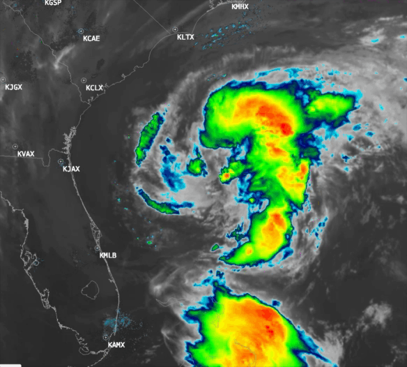
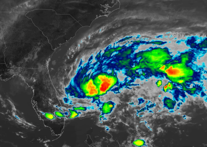
At 11pm last night the National Hurricane Center named Tropical Depression #1 “Arthur”. The current position fix of Tropical Storm Arthur is: SUMMARY OF 1100 AM EDT…1500 UTC…INFORMATION LOCATION…30.5N 77.4WABOUT 345 MI…550 KM SSW OF CAPE HATTERAS NORTH CAROLINAMAXIMUM SUSTAINED WINDS…45 MPH…75 KM/HPRESENT MOVEMENT…NNE OR 15 DEGREES AT 9 MPH…15 KM/HMINIMUM CENTRAL PRESSURE…1002 MB…29.59 INCHESContinue reading “Arthur is Born”
Tropical Depression #1 Has Formed
At 5:00pm the National Hurricane Center designated the disturbance off the Florida east coast as Tropical Depression #1 (TD #1), the first official tropical system of the not even officially started Atlantic hurricane season. Here is the position fix of TD#1: SUMMARY OF 500 PM EDT…2100 UTC…INFORMATION ———————————————- LOCATION…28.4N 78.6W ABOUT 125 MI…200 KM EContinue reading “Tropical Depression #1 Has Formed”
Southern New England Forecast
Issued Saturday May 16, 2020 3:00pm WEATHER SUMMARY: After the severe weather that passed through New England last night, today is a welcome weather treat! Comfortable temperatures and a fresh breeze make today a beautiful day to be outdoors here in the middle of May. I’m pleased to say that the weather will be justContinue reading “Southern New England Forecast”
Severe Weather Potential Update
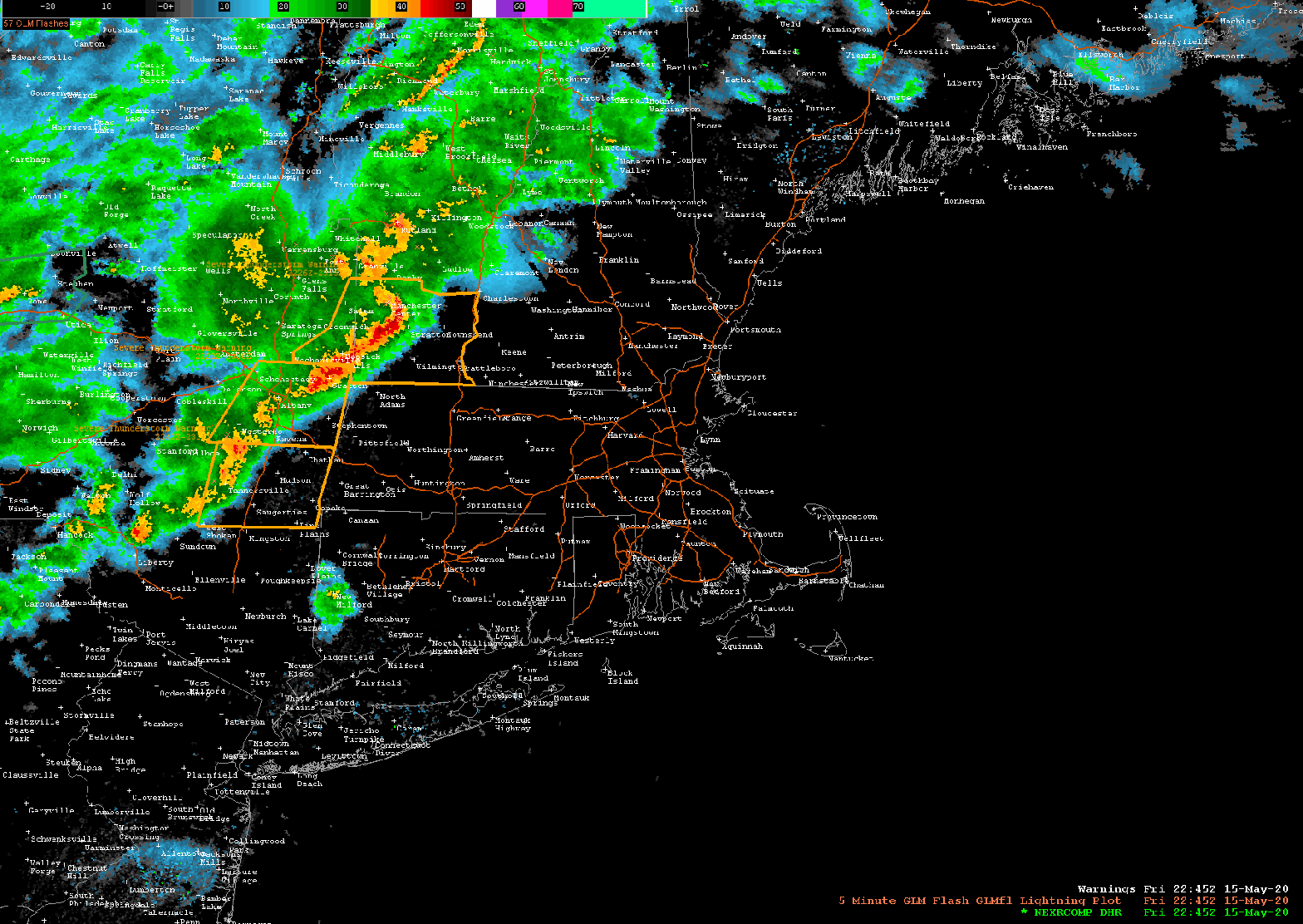
Issued Friday May 15 2020 9:15 pm The line of showers and thunderstorms we’ve been monitoring tonight has made its way through most of Massachusetts and is now pressing toward the SE into the Providence, Brockton, Taunton, and Plymouth area. The storms did weaken significantly in Eastern MA once they got inside of 495. ThisContinue reading “Severe Weather Potential Update”
Current Warnings in SNE
Severe Weather Potential Update
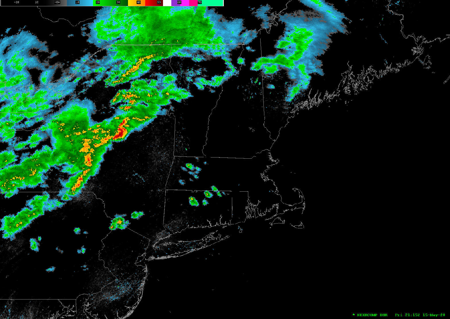
Issued Friday May 15 2020 7:55pm A line of strong showers and thunderstorms are pushing through central and western MA and SW and central NH as of 7:45pm this evening. This line of thunderstorms may contain cells which may generate damaging winds, hail, frequent lightning and the potential for small isolated tornadoes. The National WeatherContinue reading “Severe Weather Potential Update”
