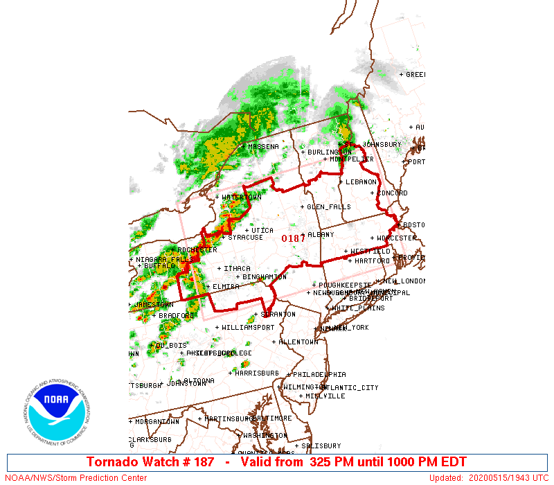
URGENT – IMMEDIATE BROADCAST REQUESTED Tornado Watch Number 187 NWS Storm Prediction Center Norman OK 325 PM EDT Fri May 15 2020 The NWS Storm Prediction Center has issued a * Tornado Watch for portions of western and central Massachusetts southern New Hampshire central through eastern New York northeast Pennsylvania southern Vermont * Effective thisContinue reading “Tornado Watch”
Author Archives: Brian Treanor
Special Forecast Update
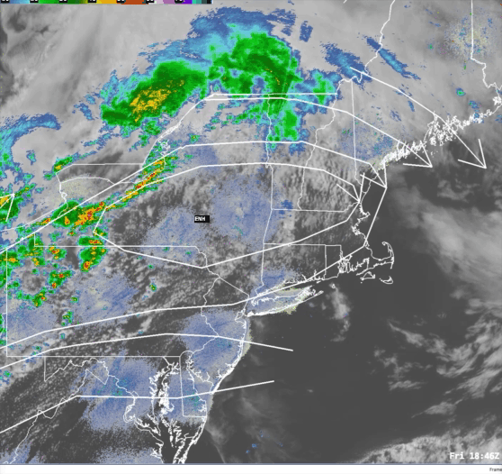
Issued: Friday May 15 2020 3:00 pm …SEVERE WEATHER POSSIBLE THIS EVENING…. The Storm Prediction Center has placed all but SE CT/Southern RI/and SE MA in either the Slight or Enhanced risk category for severe weather today. Based on current data thunderstorms are blossoming in western New York state and northern Pennsylvania. This is inContinue reading “Special Forecast Update”
Southern New England Forecast
Issued Wednesday May 13, 2020 6:00pm WEATHER SUMMARY: An upper level low exiting the northeast this evening is taking the core of this rather coolish air that we’ve had over us over the last few days with it. Replacing it is an area of high pressure building in from the Ohio Valley that will controlContinue reading “Southern New England Forecast”
Southern New England Forecast
Issued Monday May 11, 2020 9:30pm WEATHER SUMMARY: ..BELOW NORMAL TEMPS TO START THE WEEK, WARMING UP BY THE WEEKEND……WARMER STILL NEXT WEEK?… So we managed to squeeze out a few showers today as a storm system passed through northern New England. On the back side of this system we are going to have anContinue reading “Southern New England Forecast”
Special Forecast Update

Issued: Monday May 11 2020 9:55 am ….WHERE IS THE RAIN? IT’S COMING LATER TODAY…. So, looking at the forecast I issued on Saturday I figured that clouds and rain today would be a safe bet. Yeah, right. The system that will ultimately bring those two things to us today is a little slower gettingContinue reading “Special Forecast Update”
Southern New England Forecast
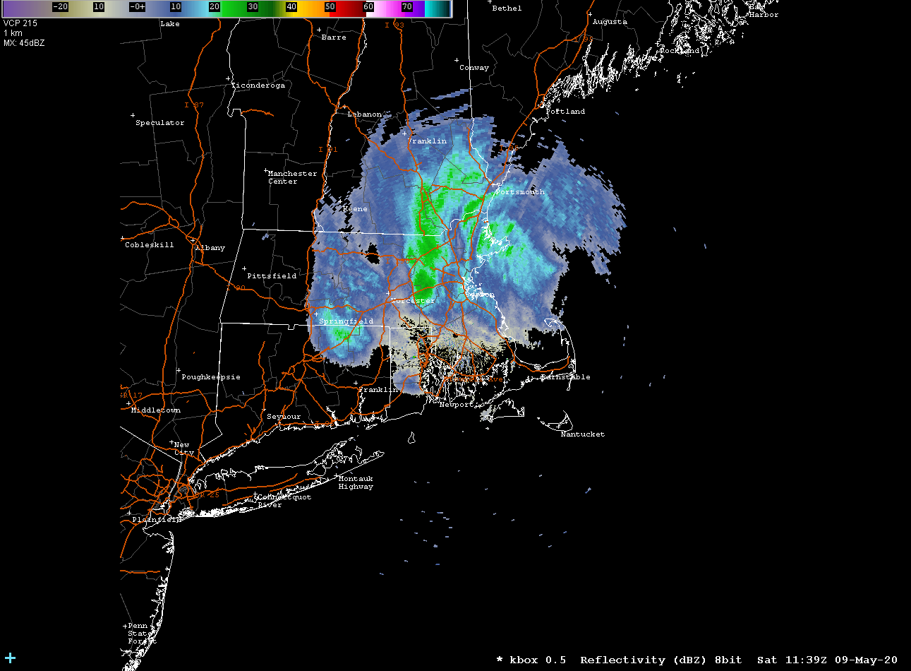
Issued Saturday May 9th @ 8:40 pm WEATHER SUMMARY: ….A NICE DAY FOR MOM, RAIN (BUT NO SNOW) FOR MONDAY, MODERATION COMING…. Well the little light snow event we had this morning should be the end of it till the next cold season. Tonight will be a little bit chilly as a west wind advectsContinue reading “Southern New England Forecast”
Special Forecast Update
Issued: Saturday May 9 2020 8:45 am ….JUST A TEASE…..A LITTLE SNOW TO START THE DAY…..NO ACCUMULATION…. Good morning! I know, many of you are reading this and are saying to yourself “I thought you said it wouldn’t snow!” Well, I did say there wouldn’t be any accumulation and that’s my story still and I’mContinue reading “Special Forecast Update”
Special Forecast Update
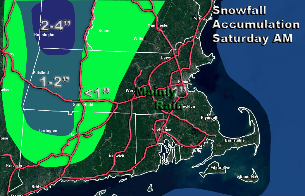
Issued May 8 2020 7:28 pm ….IT WILL BE WET BUT NOT VERY WHITE… So over the last few days we’ve been tracking a storm that, by all accounts, looks very cold. It caused a little worry that we might have a kind of May 9, 1977 situation on our hands where some interior portionsContinue reading “Special Forecast Update”
Southern New England Forecast
Issued Thursday May 7th @ 6:30 pm WEATHER SUMMARY: ….IS IT MAY OR MARCH? HARD TO TELL DURING THE NEXT 48 HOURS…. Looking over the weather maps today it is sometimes hard to tell whether we are heading into the middle to late part of Spring or just ending the Winter. Looking at the overallContinue reading “Southern New England Forecast”
New England Forecast
Issued Monday May 4th @ 6:00 pm WEATHER SUMMARY: After a beautiful sparkling start to the day today, as forecast, we got stuck with cloudy overcast skies by afternoon. This was due to the movement of an upper level disturbance over New England. Combine that with unstable air and you’ve got clouds and even aContinue reading “New England Forecast”
