Southern New England Forecast

***NEW FEATURE! You can get these forecasts and blog entries delivered directly to your e-mail. Click the button at the bottom of this post to subscribe!***

Issued: Thursday June 4 2020 8:00 pm

3-DAY FORECAST:

TONIGHT/OVERNIGHT: Cloudy with the risk of showers especially toward sunrise. Winds S 5-10 mph. Low temperatures 62-68.

FRIDAY: A Cloudy start with the risk of morning showers, showers ending by late morning with some afternoon sun before clouds thicken again by sunset. Winds SW 5-10 mph gusts to 20 mph. Muggy with high temperatures 78-83.

FRIDAY NIGHT:  Mostly cloudy with the risk of evening and overnight showers especially across CT/RI/MA South Coast and Cape Cod. Winds S-SW 5-10 gusts to 10-15 mph. Low temperatures 65-70 over eastern MA. 60-65 elsewhere.

SATURDAY: Mostly cloudy, muggy and warm. Chance of afternoon thunderstorms especially during the early portion of the afternoon. Turning cooler and less humid toward sunset. SW winds 10-15 mph with gusts to 25 mph. Winds becoming NW 10-15 mph with gusts to 20 mph by evening. Highs 82-87, cooler on the Cape and in the Berkshires.

SATURDAY NIGHT: Becoming mostly clear. NW winds 5-10 with gusts up to 15 mph. Low temperatures 55-60.

SUNDAY: Mostly sunny with low humidity and afternoon fair weather clouds popping up. Highs 70-75.

EXTENDED FORECAST:

MONDAY: Sunny. High 75-80. Low 50-55.

TUESDAY: Mostly Sunny. High 80-85. Low 50-55.

WEDNESDAY: Partly Sunny. High 80-85. Low 55-60.

THURSDAY: Partly Sunny to Mostly Cloudy. Highs 75-80. Low 55-60.

SpaceX Dragon Launch – Take 2!

The second attempt at getting the SpaceX Dragon spacecraft into orbit with a crew of 2 American astronauts will take place again today. The launch is scheduled for 3:22pm from launch pad 39A at the Kennedy Space Center in Florida.

The weather, once again, will play a crucial role in determining whether or not the Falcon 9 rocket with the Dragon capsule on top will get off the launch pad today.

The first challenge will be the weather around the launch pad at launch time. Currently there are showers and thunderstorms developing within a 10 mile radius of the launch site (the bullseye inside the 1 mi, 5 mi and 10 mi range rings I’ve set up). This has the potential to be an issue if these thunderstorms persist up to launch time. It would be especially bad if these storms are inside the 10 mi range ring very close to launch time. This could cause the launch to be aborted. Further, if there are storms with a lot of lightning near the launch area this will cause electric fields to develop that could spark lightning if the rocket is launched. Presently very little lightning has been detected in the area of the Kennedy Space Center. Let’s hope it stays that way.

In addition to the surface weather we also have to look up to see if the winds at higher levels of the atmosphere are favorable for a launch. Spacecraft cannot launch into strong upper level winds due to the massive dynamic stress the craft experiences during its initial ascent through the atmosphere. Luckily the upper level winds are forecast to be 25 kt or less all the way up through about 10 miles during the rockets ascent phase.

Another major consideration is weather downrange from the launch site. The rocket will achieve earth orbit about 9 minutes after lift off. The trajectory of the rocket (shown below) takes the spacecraft along the eastern seaboard of the US, skirting past Newfoundland, across the North Atlantic Ocean to just south of the United Kingdom.

Given that, in the event of an abort, the Dragon capsule must splashdown you have to make sure that the weather is favorable for a rescue at sea. So, you have to have good weather and relatively calm seas. Also, you have to have a relatively quiescent atmosphere to come down through given that you’re flying by way of parachute. Parachuting through a thunderstorm probably wouldn’t be the most fun ride ever. The image above shows the sea state and forecast radar image at 3pm today. You’ve got relatively calm seas of 3-5′ along the eastern seaboard so that’s good. What’s less good is a line of showers and thunderstorms just off the North and South Carolina coasts. These storms are a little close to the trajectory of the rocket but just a little to the west. This may allow for the margin of safety needed in the near downrange portion of the flight. Further along, southeast of New England and Nova Scotia things look pretty good with 4-7′ seas but no major storms. There is a zone, shown in red above, where NASA would not want to see Dragon splash down due to the usually rough seas and weather over the North Atlantic Ocean. Fortunately the Dragon capsule is designed that it can turn back to the west and splash down just off of the coast of Atlantic Canada or further west just off the Irish coast. The weather in both places looks pretty good.

So, in short it looks like:

  • Surface weather will be dependent on where the thunderstorms are close to launch time
  • Upper level weather looks good through 10 mi up with relatively light winds and almost no wind shear.
  • Downrange weather looks relatively good though there may be some thundershower activity to worry about off the SC/NC east coast.

If these parameters don’t exceed the safety thresholds, we should be go for launch. NASA says that the odds are 50-50 for a launch. Less than an hour till lift off!

The Saturday Morning Briefing

Issued: Saturday May 30 2020 9:00 am

A cold front is currently pushing through central MA and CT and will continue to press on through the rest of southern New England moving through the Boston area around noon and then finally exiting by way of Cape Cod tonight.

Most of the shower activity associated with this front is well ahead of it but don’t be surprised if a shower or two does develop over SE MA by later this afternoon.

Today temperatures will top out around 80 degrees across much of the area but dewpoints behind the front are in the 50’s so much less humid air will work into much of SNE by this afternoon and tonight.

Sunday should be a beautiful day with bright sunshine, temperatures in the low to mid 70’s, and low humidity.

Enjoy!

Southern New England Forecast

***NEW FEATURE! You can get these forecasts and blog entries delivered directly to your e-mail. Click the button at the bottom of this post to subscribe!***

Issued Friday May 29 2020 6:00 am

Friday Night Surface Weather Map (Wind, Precipitation, Temperature, Surface Pressure and Frontal Analysis)

3-DAY FORECAST:

THIS MORNING: Mostly to partly cloudy and warm with the risk of showers on the Cape westward into southern RI. SW winds 5-10 mph with some higher gusts. Temperatures starting off around 70 degrees rising into the mid to upper 70’s from Boston to the west and north by late morning, and into the lower 70’s CT/RI and S. Shore and 65-70 on the Cape all by late morning.

THIS AFTERNOON: Partly cloudy and warm. Risk of showers over S RI/Cape Cod and the Islands. Winds SW 10-15 mph gusting to 20-25. High temperatures 75-85 over all of eastern MA, northern RI, and CT except along the south coast. 60-75 from the outer cape to the MA south coast and the RI/CT south coast.

TONIGHT/OVERNIGHT: Mostly cloudy risk of showers over western MA, Cape Cod and the Islands and S RI coast.  Wind SW 5-15 mph.  Low temperatures 65-70.

SATURDAY: Cloudy to start the morning with showers exiting CC and the Islands, gradual clearing into the late morning and afternoon everywhere.  Winds SW winds turning W-NW by noon. 5-10 increasing with gusts 15-20 especially during the late AM and early afternoon. High Temperatures 77-82.

SATURDAY NIGHT:  Partly Cloudy.  Winds NW 5-10 mph with a few higher gusts.  Low temperatures 55-60 in eastern MA and RI, 50-55 in central sections of MA/E CT, 45-50 in western MA/Berkshires.

SUNDAY: Sunny.  NW 10-15 mph with higher gusts. Highs 65-72 west to east.

SUNDAY NIGHT: Mostly Clear. Winds light out of the NW. Lows 40-50 west to east.

EXTENDED FORECAST:

MONDAY: Mostly sunny to start, clouds move in with the chance of showers in the early evening.  Highs in the upper 50’s in western MA, mid to upper 60’s east and central sections of MA/RI. Around 70 in CT.

TUESDAY: Partly Sunny.  Highs 65-70.

WEDNESDAY: Cloudy.  Highs near 70-75.

THURSDAY: Mostly Cloudy. Highs around 75.

Southern New England Forecast

***NEW FEATURE! You can get these forecasts and blog entries delivered directly to your e-mail. Click the button at the bottom of this post to subscribe!***

Issued Thursday May 28 2020 5:00 am

3-DAY FORECAST:

THIS MORNING: Partly to Mostly Cloudy.  Wind S 5-10 mph.  Temperatures starting in the mid 60’s rising into the mid to upper 70’s by late morning except along the immediate coast, the South Shore, Cape Cod, and the Islands where temperatures will hold in the mid to upper 60’s up to the Cape Cod Canal and 60-65 degrees on the upper cape, upper 50’s mid Cape, 45-50 outer Cape.   

THIS AFTERNOON: Varying amounts of clouds and sun especially north of Boston.  More overcast to the south and west.  Risk of a shower or two, especially south of the Mass Pike.   S-SW winds 10-15 mph.  Highs 55-65 along the SNE south coast, Cape and Islands.  70-75 in the immediate Boston area, through most of CT and RI, western and central MA, and near 70 in the Berks, 75-80 in the immediate western Suburbs of Boston and 80-85 in the northern part of Middlesex county through southern New Hampshire in the Lowell to Concord corridor where the sun will stay out the longest. 

THIS EVENING/OVERNIGHT:  Partly to Mostly Cloudy.  SW winds 5-10 mph.  Low temperatures in the mid to upper 50’s along the coast, 60-65 inland. 

FRIDAY: Partly cloudy and warm.  Mostly cloudy with the risk of showers on the Cape westward into RI.   Winds SW 10-15 mph with higher gusts.  Highs 75-80 north of the Mass Pike, 60-70 from the CT/RI/MA south coasts through the interior up to the MA border/mid south shore.  Highs 70-75 in Boston and along and just south of the Mass Pike.

FRIDAY NIGHT: Mostly cloudy risk of showers.  Wind S 10-15 mph.  Low temperatures 58-63

SATURDAY: Variable clouds to start, becoming mostly cloudy by afternoon.  Showers and possibly a thunderstorm moving into western MA by morning moving into E MA by late afternoon.  Winds SW turning into the W-NW by 5pm. 5-10 increasing to 10-15 with higher gusts late in the day.    Highs 75-80.

SATURDAY NIGHT:  Becoming mostly clear, breezy, cooler and less humid.  Winds NW 5-15 mph.  Low temperatures 55-60 in eastern MA and RI, 50-55 in central sections of MA/E CT, 45-50 in western MA/Berkshires.

EXTENDED FORECAST:

SUNDAY: Mixture of clouds and sun with low humidity.  Highs 65-75 west to east.

MONDAY: Mostly sunny to start, clouds move in with the chance of showers in the early evening.  Highs in the upper 50’s in western MA, mid 60’s central Mass and near 70 in the east.  

TUESDAY: Mostly sunny.  Highs 65-70.

WEDNESDAY: Cloudy.  Highs near 70.

America Returns to Space, Weather Permitting

Today the United States will launch its first live crew into space from US soil since the last Space Shuttle launch in 2011. The SpaceX rocket “Dragon” will launch a test crew of 2 into space today from the historic launch pad 39A at the Kennedy Space Center, FL. The launch is set to occur at 4:33 pm about 2 hours from now.

The weather will play a huge part in whether or not the SpaceX craft will make it off the launch pad today. A rocket launch from pad 39A requires that the weather is within strict parameters both at the launch pad itself and for thousands of miles down range from the launch pad in the event that the mission must be aborted before orbit is achieved (usually around 9 minutes after launch). Those weather criteria are shown below:

Looking at the current weather situation at the launch site, it looks like things are a bit on the iffy side for the launch.

There are numerous showers and thunderstorms which have developed around the launch site which may put the 4:33pm launch in jeopardy. Just a short time ago there was a tornado warning that clipped a part of the 10 mile region around the launch site. That warning has since expired but it’s indicative of the problem that Dragon may run into today with weather.

If the launch takes place, the upper level winds are quite favorable for the rocket to travel through with fairly light 5-20 knot winds for the first 50,000 ft of ascent.

The weather down range from the launch site also must be in good shape as the Dragon capsule must splash down in the event of an abort. It looks like down range weather will be favorable as the sea state along the rockets launch trajectory is about 3-7′ with relatively light winds, around 10 kt from Cape Canaveral, FL along the eastern seaboard to just SE of Nova Scotia.

So, in short, if we can keep the thunderstorms and lightning strikes away from the 10 mile radius around the launch pad we should be good to launch. Currently NASA is saying that it’s about a 50-50 chance that the launch will go off today. If it does, NASA and SpaceX make history!

Hi Bertha, Bye Bertha!

….Hi Bertha! Bye Bertha!….

At 8:30am this morning Tropical Storm Bertha was born off of the South Carolina coast. Bertha has maximum sustained winds of around 45 mph and was heading off to the NW at 9 miles per hour. That was 8:30am. By around 9:10am radar indicated that the center of Bertha had crossed the coast just northeast of Charleston SC. Bertha is forecast to weaken and dissipate by 2pm tomorrow.

Bertha will bring heavy rainfall and gusty winds to SE and Central SC.

The Morning Briefing

The back door cold front that will bring much cooler and drier conditions to SNE by this afternoon looks to be making its transit through SNE as we speak. At 8am the front appears to have passed through Boston proper, all of Essex county and the eastern portion of Middlesex county. The front will continue its march off to the SW during the day today fully penetrating all of SNE by this evening. Temperatures are going to begin to fall dramatically by later this morning into the afternoon plunging from current levels (upper 60’s to low 70’s at this time) into the mid and upper 50’s by 2pm. The change that accompanies the passage of the back door cold front will be abrupt with a sudden wind shift into the NE with gusty winds of around 20 mph.

We’ve managed to hit the highest temperature we’re going to see for the day today. Warmer weather will return by the middle of next week.

Southern New England Forecast

***NEW FEATURE! You can get these forecasts and blog entries delivered directly to your e-mail. Click the button at the bottom of this post to subscribe!***

Issued Saturday May 23 2020 1:45 am

WEATHER SUMMARY:

What a day Friday was! A beauty with bright sunshine most of the day and rather warm temperatures across the region. Before we talk about the cooler holiday weekend we are about to have I thought we should take one last look at our Friday summer preview.

On Friday, high temperatures in New England and the Northeast were well above seasonal norms. Here are a few reports from cities around our area:

Boston, MA: 82 deg F
Providence, RI: 80 deg F
Hartford, CT: 82 deg F
Bridgeport, CT: 75 deg F
Albany, NY: 82 deg F
Concord, NH: 87 deg F
Portland, ME: 85 deg F

That’s pretty good for late May in New England! Concord, NH won the award for the highest max temp and the coolest reading was in Bridgeport, CT where the wind was a bit on shore. So, overall we had a super Friday to start off the long weekend. Thing is this IS New England and as the saying goes, just wait a minute and our weather is bound to change.

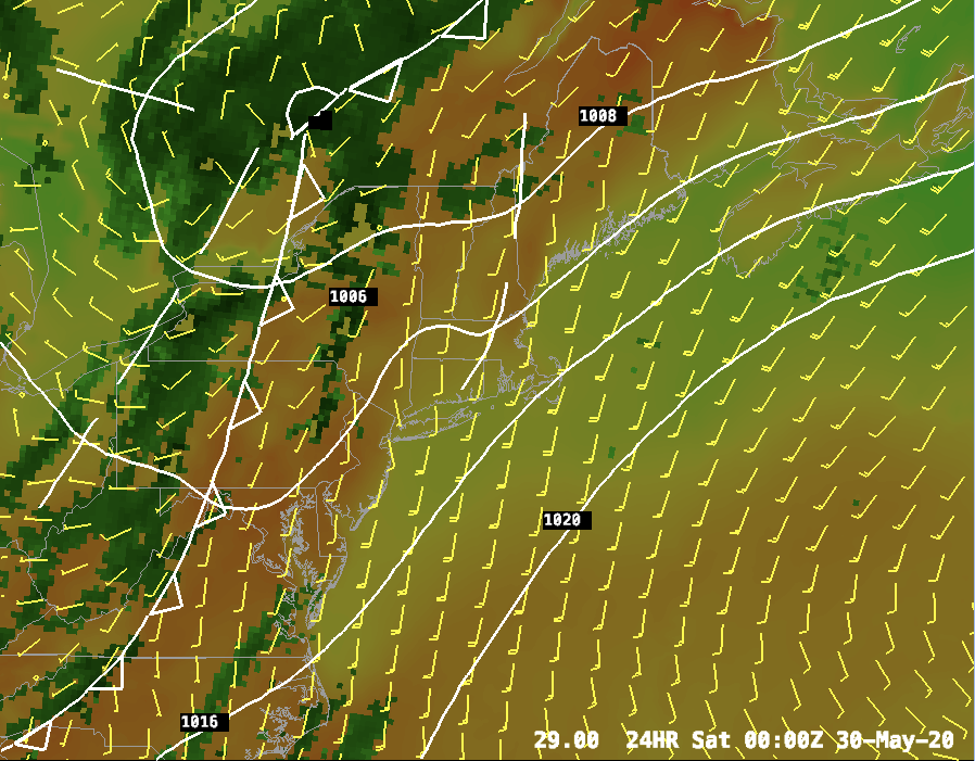
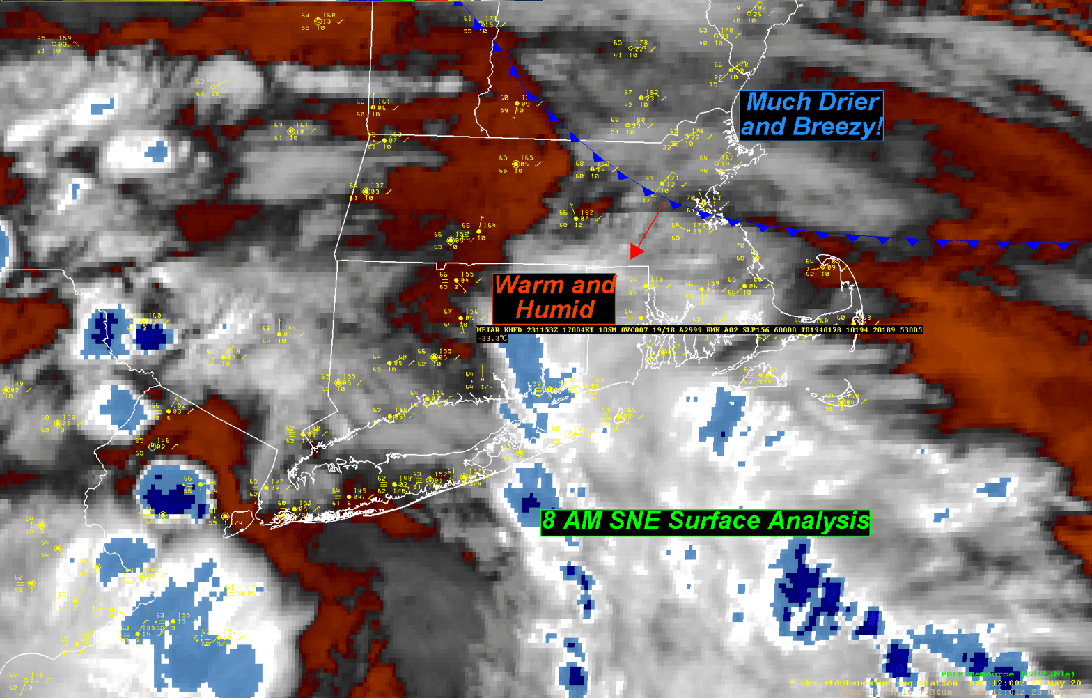
It most definitely will change over the next 24 hours. We will start off tomorrow morning pleasant enough with temperatures rising into the low to mid 60’s during the early part of the morning across the state. That warming trend won’t last, unfortunately, as a back door cold front will be pressing southwestward from Maine into the Boston area by 8-10 am. Once that front passes through there will be a noticeable wind shift from the SW to the NE and temperatures will respond accordingly. Temperatures will drop from the mid 60’s into the 50’s by early Saturday afternoon and into the mid to upper 40’s by Saturday night. This cooler air will penetrate throughout all of southern New England.

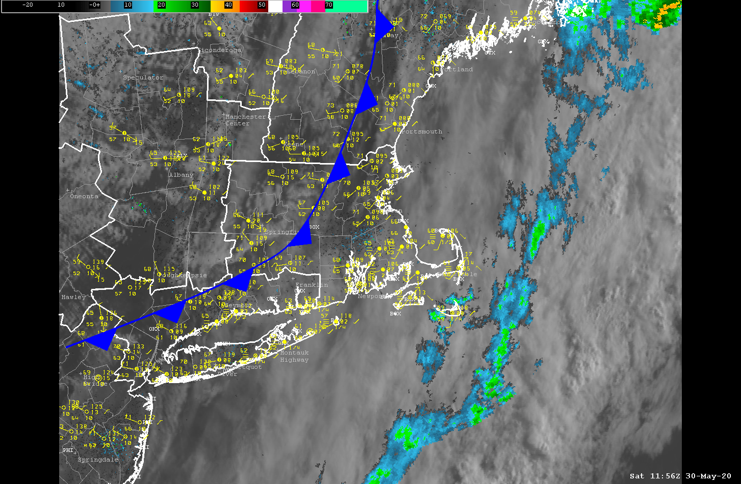
We will also be contending with the remnants of the closed upper level low that’s been hanging out in the Tennessee Valley over the past week. This system will be passing to our south and will throw clouds and the chance of showers over much of Southern New England with a particular emphasis on CT/RI/SE MA, the Cape and Islands.

By Sunday high pressure to our east will continue to pump in the cool maritime air and while we should be mostly sunny, we will be quite chilly with highs only in the low to middle 50’s. Way below climatology which would suggest a high of around 72 at this time of year.

The below normal temperatures will continue into Monday but then for Tuesday and beyond we can expected to be a little unsettled but temperatures will rise once again into the 70’s for Tuesday and then back into the low 80’s for late next week.

DETAILED FORECAST:

FRIDAY NIGHT/OVERNIGHT: Increasing clouds. Showers developing over W MA/CT/RI after midnight. Winds Calm. Lows 55-60.

SATURDAY: Cloudy with showers especially to the south of the Mass Pike. Winds becoming E 10-15 with gusts up to 25 mph. Highest winds in E MA/E CT/RI. Highs around 60-65 just about everywhere around 8-9am then temperatures falling rapidly through the afternoon into the mid 50’s by early/mid afternoon.

SATURDAY NIGHT/OVERNIGHT: Becoming mostly clear. Winds NE 5-15 mph. Lows 40-50.

SUNDAY: Mostly Sunny. Highs 50’s over the cape, low 60’s near Boston, 65-70 central and western MA and CT.

SUNDAY NIGHT: Partly cloudy. Winds E 5-10 mph. Low temperature 45-50.

MONDAY: Mostly Cloudy. Winds N 5-10 mph. Highs 60-65.

MONDAY NIGHT/OVERNIGHT: Cloudy. Winds turning into the S 5-10 mph. Lows 50-55.

TUESDAY: Mostly Cloudy. Highs 72-77, cooler coast.

WEDNESDAY: Cloudy to the east, mix of sun and clouds west. Highs 80-85.

THURSDAY: Partly cloudy and a little muggy. Highs 80-85

Southern New England Forecast

***NEW FEATURE! You can get these forecasts and blog entries delivered directly to your e-mail. Click the button at the bottom of this post to subscribe!***

Issued Friday May 22 2020 12:45 am

WEATHER SUMMARY:

This forecast is being issued as an update to Thursday’s forecast to tweak temperatures for tomorrow. I am bumping up high temperatures considering that highs today got into the mid and upper 70’s even into the city of Boston. Looks like Friday is going to be a rather summer like day with a brisk SW breeze and highs in the low 80’s across much of the area and all the way to the coast line, except for the west facing coast of Buzzard’s Bay and the upper portion of Cape Cod where temperatures will hold in the 65-70 degree range and 60-65 mid cape and 55-60 on the outer Cape.

DETAILED FORECAST:

OVERNIGHT: Mostly clear. Winds SW 5-10 mph. Lows 45-50.

FRIDAY: Mostly Sunny. Winds SW 5-10 mph with higher gusts up to 20 mph. Higher winds on the Cape and Islands. Highs 80-85 throughout much of MA except cooler at all south and southwest facing coastline areas.

FRIDAY NIGHT/OVERNIGHT: Increasing clouds. Showers developing over W MA/CT/RI after midnight. Winds Calm. Lows 55-60.

SATURDAY: Cloudy with showers especially to the south of the Mass Pike. Winds becoming E 10-15 with gusts up to 25 mph. Highest winds in E MA/E CT/RI. Highs around 65 inside 128 by late morning then temperatures will fall into the upper 50’s. 55-60 on Cape Cod, west of 128, through RI and CT afternoon highs will be 65-70 and west of Worcester but east of the Berks and north of the Pike temperatures will rise to near 75.

SATURDAY NIGHT/OVERNIGHT: Becoming mostly clear. Winds NE 5-15 mph. Lows 43-50.

SUNDAY: Mostly Sunny. Highs 50’s over the cape, low 60’s near Boston, 65-70 western MA and CT.

MONDAY: Mostly Sunny. Highs 70-75 except cooler at the coasts.

TUESDAY: Partly Sunny. Highs 72-77, cooler coast.