….MAY THE 4TH BE WITH YOU, AND A NICE MORNING TOO!….
We’ve got a phenomenal morning underway as a deep layer of dry air moves over all of New England. I am expecting clear to mostly clear skies through the morning hours today so enjoy it! By afternoon an upper level pulse of energy will swing through New England and, with a little support from some middle and low level moisture that will pinwheel through the area, we will see cloudiness develop this afternoon. It’s unstable enough that there could be a pop up shower or two (maybe three?) here and there around New England. By sunset the shower threat will end across southern New England. A bit closer to the exiting upper level disturbance, through central and northern Maine expect clouds and the risk of a rain (or snow at higher elevations) shower to continue overnight. High temperatures today should be in the middle to upper 60’s for most areas except for northern VT/NH and central and northern ME where temperatures will stay in the low 50’s to near 60 degrees.
Tomorrow should be another fairly nice day with mostly clear skies but temperatures will be a little bit cooler with highs around 50 to the north and into the low 60’s in southern New England.
5am Thursday PREDICTED weather map.
A storm may take shape along the mid-Atlantic coast by Wednesday afternoon and bring some precipitation our way Wednesday night and Thursday. It seems unbelievable that I should have to say this, but, the precipitation type for this storm is a bit up in the air right now. It could be cold enough for accumulating snow to fall in New England. Just how close to the coast that accumulating snow penetrates is the big question. I’ll be looking this over and will have a little more detail when I release my new forecast for New England later today.
Look out the window this morning and you will find crystal clear skies across all but northern ME. Temperatures in southern New England are in the middle 50’s down to the middle 40’s across central and northern ME.
With abundant sunshine high temperatures will reach 65-70 across RI/MA/CT, 60-65 across southern NH, southern VT and SE ME, 55-60 across northern VT/NH and central maine and around 50 degrees across northern Maine and near 45 up by the ME/Canadian border.
Overnight tonight a warm front will approach and skies will become overcast and there may be a shower or two as the warm front passes through. Unlike past warm fronts this one will not get stuck as it tries to move through Southern New England. Strong westerly winds aloft will help move the warm front along and winds at the surface will flip into the SW by Sunday morning with clearing skies. This turning of the wind into the SW will also allow for a much warmer day on Sunday. I expect to see temperatures reaching or exceeding 70 degrees especially away from the south and east facing coastlines and east of the Worcester hills, and throughout much of NW RI and all of CT. Mid 60’s will be in place for much of central New England and readings will reach the upper 50’s to around 60 for Northern NH/VT. ME unfortunately gets the booby prize on Sunday as the warm front will not quite make it through there. Mid 60’s will be possible in the far southern part of the state but temperatures will fall rapidly across the warm front and from just north of Portland northward expect temperatures in the 40’s to near 50 with cloudy skies and rain likely from Bangor to Caribou.
A dry cold front will pass through by late Sunday/Sunday night and that will make temperatures a little cooler for Monday but it still should be rather nice
…THE SUN HAS EMERGED, WATCH OUT FOR SHOWERS IN THE NEXT 3-4 HOURS…
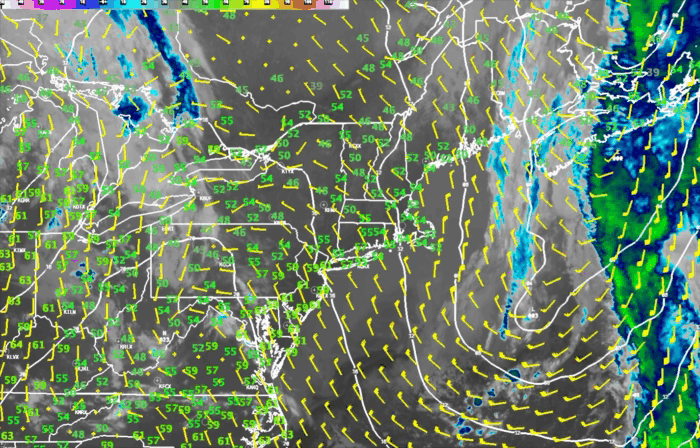
The sun has managed to poke its head out here and there over Eastern MA and RI but don’t be fooled. This sunshine will cause cloudiness to redevelop very quickly and shower activity is likely to form as the atmosphere is rather unstable. Looking at the satellite and radar loop above you can see a large area of showers has developed over Western Mass and this kind of shower activity could increase in areal coverage as we move through the rest of the daylight hours if the sun stays out. The greatest risk of developing showers will be over Eastern MA during the next 2-3 hours as upper level energy swings through with the upper level trough passing through New England right now. Once the sun goes down that will serve to stabilize the atmosphere and the shower threat will largely disappear.
….THE RAIN IS ABOUT OUT OF HERE, AFTERNOON SHOWERS? SPLENDID WEEKEND….
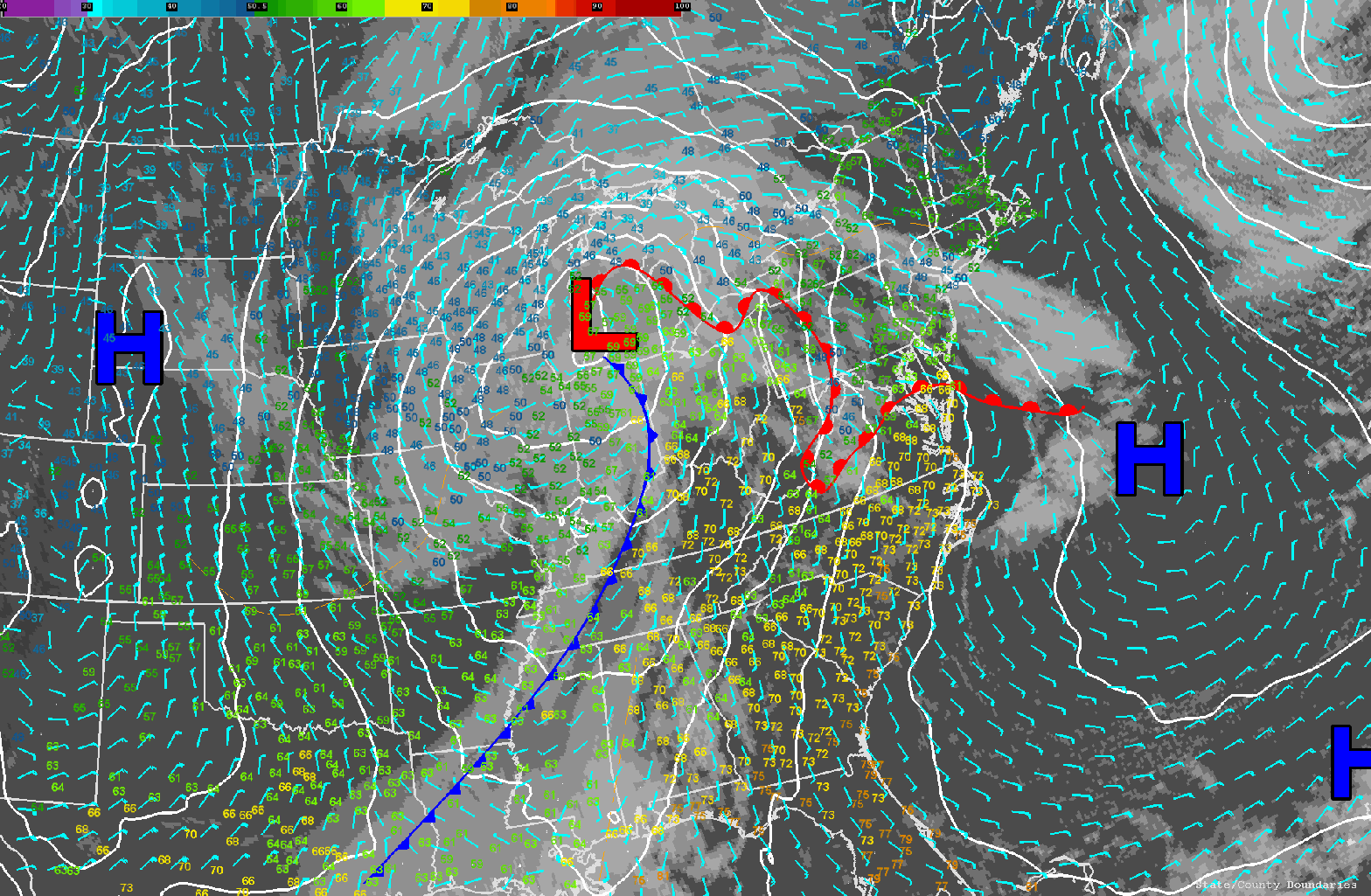
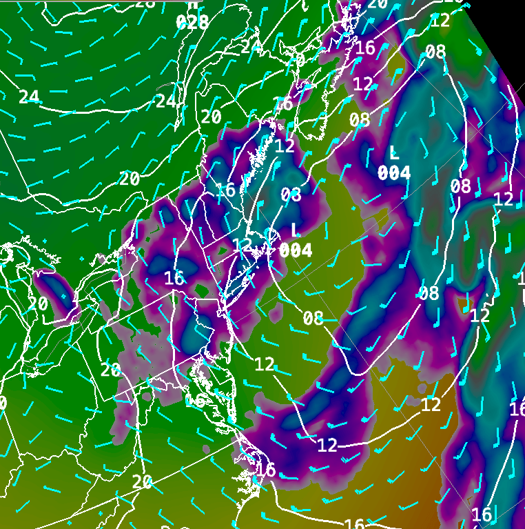
The third storm of our 3 storm trifecta over the past week is upon us and things seem to be performing just about as expected after a week of indecision among the computer models. As depicted yesterday this system has moved right along after emerging from the Ohio Valley yesterday. Presently low pressure is redeveloping just south of Long Island and we’re seeing a pretty substantial shield of rainfall move through New England as a result. The good news is the back end of that slug of rainfall is now moving into SW RI, Central Massachusetts and SW NH. Rain is starting to ramp up in SE and Central ME.
I expect that the main area of rainfall should be mostly out of MA/RI and NH by 10-11 am. Rainfall will continue into the state of Maine with the back side of that main shield of rain moving through the state by early evening. As this afternoon rolls on an area of low pressure in the upper atmosphere will move over New England and that should leave the clouds locked in and there is the risk of further shower activity developing in Southern New England during the midday and early evening hours.
All of this weather activity will finally come to an end by Saturday morning as the upper level trough axis pushes offshore and is replaced by a ridge of high pressure which should supply ample sunshine and fairly calm weather for Saturday.
On Sunday, a weak wave of low pressure will track through New England and this may generate a few showers during the morning hours. It looks like this system will move through very quickly and the weather will quickly improve by Sunday afternoon.
By Monday another upper level low will settle over the northeast and while I don’t think it will bring much in the way of shower activity with it, it will keep things a little cooler on Monday in comparison to the warmer weather that I’m expecting for Saturday and Sunday.
In the longer range, the next weather maker of any real significance will move into New England Wednesday afternoon into Thursday morning.
….ONE MORE STORM TO GO AND THEN SPRING FINALLY ARRIVES….
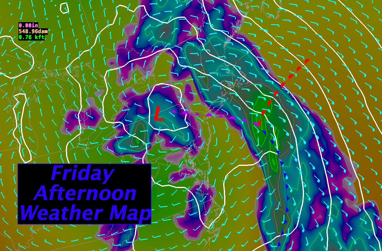
Low pressure, surface and aloft, moving through the Ohio Valley will push an area of rainfall into New England this evening and overnight. This should be a decent rain event with precip. water values of over 1.00″ advecting into New England by early Friday morning.
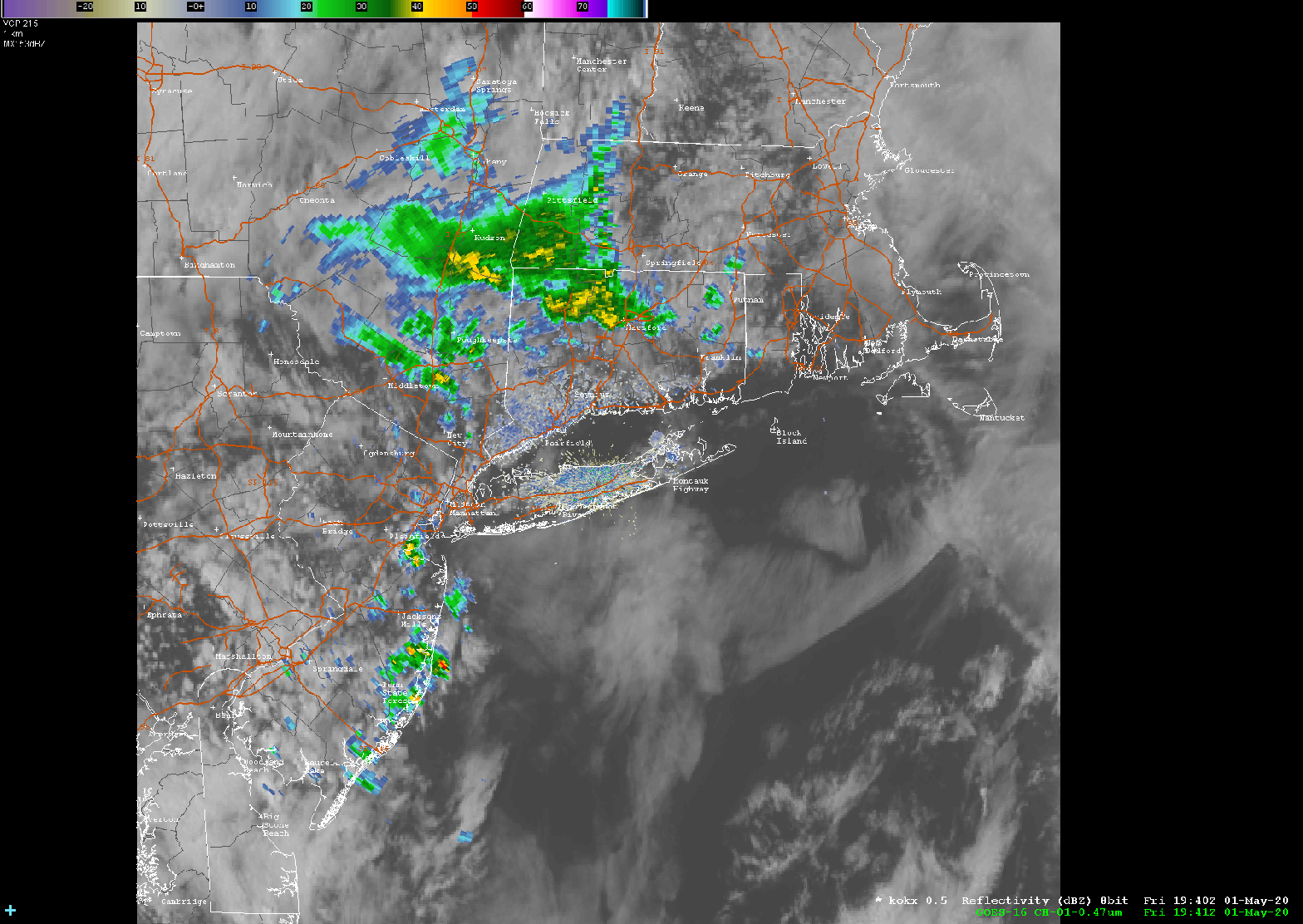
Predictive Radar Loop from Thursday Afternoon through Friday Morning
Rainfall amounts should be in the half to one inch range for much of SNE. There was disagreement among the models as to how progressive this system would be but that disagreement seems to have largely resolved and it appears this system is going to be out of here by Saturday morning. Once it’s gone, the weather settles down for a bit (finally!) and we get a stretch of mostly sunny days with seasonable or slightly above average temperatures over much of New England.
DETAILED FORECAST:
THIS AFTERNOON: Overcast with a few showers possible especially. through central MA. Steadier rain can be found in spots on a line from Rumford to Allagash, ME Highs 43-52 throughout New England except 53-60 over SW CT. Winds E- SE 10-20 mph with gusts up to 30 mph.
THIS EVENING/OVERNIGHT: Cloudy with spotty showers, especially to the north. Rain overspreading CT/VT and western MA by midnight. Into Eastern MA/NH/RI by 3-5 am. Winds SE 10-20 mph. Gusts 30-45 mph along the New England south coast and in northern ME, NH, VT, 25-35 mph across most of MA, central VT/NH, and along the Maine coast. Low temperatures 35-40 across interior ME/N. NH. 45-50 S NH/coastal ME and S VT 48-53 MA/RI/CT.
FRIDAY: Rain heavy at times especially in the morning NH/CT/VT/RI/MA. Rain developing and becoming heavy at times by afternoon in ME. Rain tapering off and ending by afternoon in VT/MA/CT/RI/NH. .50 – 1.15″ possible. SE winds 5-10 mph over CT/W MA/NH/ and interior ME. SE winds 15-25 mph along the MA/RI/ME coastline. SE winds 25-30 mph over Cape Cod. Gusts 25-35 RI/E MA/SE ME. Gusts 40-60 mph on the Cape. Highest winds through early afternoon diminishing after 2pm. High Temperatures 55-60 south and east facing coastal areas. 60-65 inland.
FRIDAY NIGHT: Rain tapering off and ending by early evening just about everywhere. Remaining mostly cloudy. Winds light and variable. Lows 45-50.
SATURDAY: Mostly Sunny. Highs 55-60 in northern ME, 60-65 across central and southern ME/N NH/N VT, 65-70 for the rest of the region.
SUNDAY: Mostly Sunny. Highs 60-65 throughout ME, 65-70 VT/NH/MA/RI, 70-75 in CT.
MONDAY:Mostly Sunny. 65-70 for southern New England, 62-67 across central New England, 60-65 N NH/VT, 55-60 Central and Northern Maine and northern VT/NH.
TUESDAY: Mostly sunny start, with some clouds moving in by afternoon. High temperatures in the mid 50-‘s north, low 60’s throughout SNE.
WEDNESDAY: Mostly sunny with highs near 60 in southern New England, mid 50’s in central New England and near 50 in northern New England.
THURSDAY: Partly cloudy, risk of a shower. Highs in the low 50’s across northern Maine, middle 50’s to near 60 from Portland, ME over to Concord, NH to Montpelier, VT. Low to middle 60’s across all of southern New England.
…Ah! A beautiful morning! Trouble lurking for Thur/Fri….
We’ve got a fantastic day on tap as high pressure is in control of our weather for now. A storm system tracking through the Upper Great Lakes this morning will figure prominently in our weather during the next 48 hours or so. This storm will begin to impact our area tomorrow as the warm front associated with this low makes an attempt to push northward into New England. The front will be slowed by the colder air dammed in near the surface over interior New England. Ultimately this will lead to quite a bit of cloudiness developing overnight tonight into tomorrow for much of New England and the risk of some shower activity as well.
As the storm progresses toward the coastline on Thursday night, clouds will lower and thicken and rain will break out throughout New England. Rain will start in the wee hours of Friday morning in the western part of the region and then advance to involve all of New England in the wet weather by afternoon.
After Friday afternoon there is some uncertainty in the forecast. The GFS is the odd man out in this argument between the different models with a more progressive system by Saturday which clears out the storm quickly. The NAM and European model are tending to form a deeper and slower storm and there is pretty good agreement between those two models. The upshot that is that we will have clouds and maybe a few showers lingering into Saturday morning before we clear out. That, unfortunately, will probably result in slightly cooler temperatures in the forecast before we hit a pretty good warming trend for Sunday into early next week.
We’ve got one more fairly nice day coming up before our next storm arrives and this 3rd storm is proving itself to be a bit of a forecasting challenge. A ridge of high pressure building in at the the surface and aloft will allow us to fully dry out at all levels through afternoon tomorrow. We should have mostly sunny skies during the morning and early afternoon hours. As a warm front approaches from the SW we will see some high and middle clouds move in over the top of us later in the afternoon. During the overnight hours the front will be trying to push through New England and this may generate a few showers and/or drizzle.
The timing of the approach of our next weather system has changed a bit since my last forecast as the models have been fluctuating with the speed of the next systems approach. As a result, it looks like the steady heavier rain from the next system will take a bit longer to get in here. The storm system on all of the computer models is intensifying rapidly as it approaches the east coast and this intensification process is tending to slow the eastward progress of the system at large. As a result we won’t see the bulk of the rain from this storm until Friday morning/afternoon. It should be a pretty good soaking, however, as the models generally agree on .50-1.20″ of rain for much of New England.
Once this system moves fully on by we should have a stretch of 3-4 fairly nice days with fairly calm weather and springtime temperatures.
DETAILED FORECAST:
OVERNIGHT: Variable cloudiness throughout New England. Light and variable winds. Low temperatures 35-40 from S. CT through RI, into Metro Boston, northward along the NH and ME coast. 25-30 west of 495 through central and western MA/S. and Central VT, NH and SE Maine away from the coast. 18-25 NH White Mountain and ME Blue and Boundary Mountain regions.
WEDNESDAY MORNING: Partly to mostly sunny. Temperatures 40-48. E winds across SNE 5-10. NE winds 5-15 across Maine.
WEDNESDAY AFTERNOON: Partly sunny with increasing clouds after 2pm. Winds SE 5-10 gusting 15-20 mph. High temperatures near 50 along the coast mid 50’s just inland from the coastal plain, 60-65 interior New England.
WEDNESDAY NIGHT: Mostly Cloudy Winds E-SE 10-15 with 20-30 mph gusts from central/western CT, western MA and VT. Low temperatures 30-35 interior Maine, 35-40 for central and northern NH/VT, 40-45 southern NH/VT/MA/CT/RI
THURSDAY: Overcast with a few showers possible. Highs 52-60 southern New England through western VT. NH/SW ME 45-52
THURSDAY NIGHT: Cloudy with spotty showers, especially to the north. Winds SE 10-20 mph. Lighter winds over interior Maine. Gusts 30-40 mph along the New England south coast, 25-35 mph across most of MA, up the Green Mountians, and along the Maine coast. Low temperatures 35-40 across ME/N. NH. 40-45 S ME/VT. 45-50 MA/RI/CT.
FRIDAY: Rain overspreading New England starting around sunrise in SW CT, spreading into the Boston, MA to Concord, NH to Burlington, VT areas by 7-9am and into SW Maine by 12pm-2pm. Rain heavy at times. .75 – 1.25″ possible. SE winds 5-15 mph over CT/W MA/NH/ and interior ME. SE winds 15-25 mph along the MA/RI/ME coastline. SE winds 25-30 mph over Cape Cod. Gusts 25-40 RI/E MA/SE ME. Gusts 40-60 mph on the Cape. Highest winds during the morning hours. High Temperatures 55-60 south and east facing coastal areas. 60-65 inland.
FRIDAY NIGHT: Rain tapering off and ending toward evening just about everywhere. Remaining mostly cloudy. Winds light and variable. Lows 45-50.
SATURDAY: Mostly Sunny. Highs 55-60 in northern ME, 60-65 across central and southern ME/N NH/N VT, 65-70 for the rest of the region.
SUNDAY: Mostly Sunny. Highs 60-65 throughout ME, 65-70 VT/NH/MA/RI, 70-75 in CT.
MONDAY:Mostly Sunny. 65-70 for southern New England, 62-67 across central New England, 60-65 N NH/VT, 55-60 Central and Northern Maine.
TUESDAY: Mostly sunny start, with some clouds moving in by afternoon. High temperatures in the mid 50-‘s north, low 60’s throughout SNE.
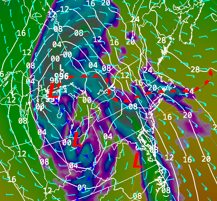
Monday Surface Weather Map…..storm lingering along the coast.
Issued Monday April 27th @ 3:00 am
WEATHER SUMMARY:
….STORM #2 LINGERS, ANOTHER ROUND OF RAIN FOR THURSDAY, THEN SPRING?….
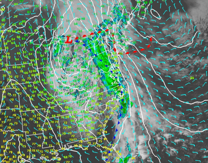
Low pressure southeast of Cape Cod this morning will not move much over the next 12 hours or so and that’s going to lead to a pretty lousy start to the week. A 60 knot low level jet oriented along the coast will continue to feed moisture into this storm system through the day on Monday and that will promote bands of rain to develop on and off throughout the day. In addition, winds will be rather brisk especially along the coast where gusts of up to 40 mph will still be possible. Higher gusts, up to 50 mph may be possible along the Maine coast as the storm deepens.
The low will pull slowly away from the coast by Tuesday and this should promote some drying to take place especially across western New England. In fact, as mid level drying moves NE into CT and W MA I would expect some sun especially later in the afternoon. It will all depend on how much low level moisture hangs on. The models suggest a sharp rise in temperature across that area Tuesday afternoon so I think you’ll have a shot of seeing a little sun at least.
The weather will quiet down a bit for Wednesday but some clouds will move in during the afternoon as a warm front works its way north through the mid-Atlantic states. This warm front could generate a few showers early Thursday as it tries to push through southern New England.
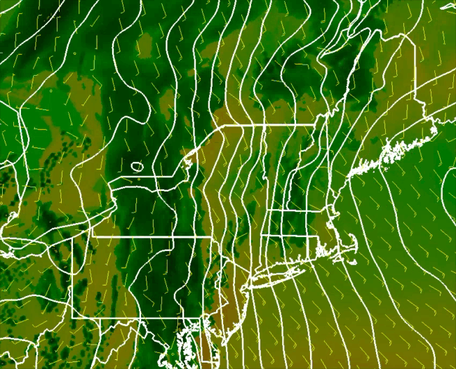
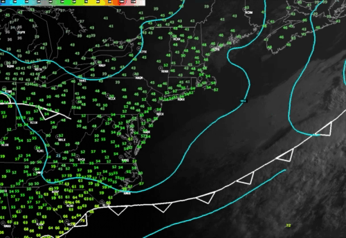
Thursday Morning Surface Weather Map – 8am
It looks to me like the warm front will stall out in Southern New England somewhere near the MA/CT/RI borders. If this front does make it a bit further north then temperatures on Thursday could end up being quite a bit warmer than currently forecast for the Boston area. As the cold front associated with a storm system moving through the Lower Great Lakes region swings through we will see some heavy shower activity pass through with the risk of a rumble of thunder. The timing on this has been a bit tricky to zone in on but I think late afternoon and evening will be the likely period for these showers to push through.
Upper level low pressure will lag behind on Friday and this will keep our weather on the unsettled side for another day. Things start to change by next weekend as the upper level low pulls away and we establish a westerly flow across the region. It will start to feel more like spring with temperatures in the 60’s and lower 70’s by Saturday and Sunday.
DETAILED FORECAST:
OVERNIGHT: Cloudy with occasional light rain, drizzle and fog overnight. Cloudy and raw. Any left over rain may change to snow across the higher elevations of central VT, central/northern NH and interior ME NW of I-95. 1-2″ of accumulation on grassy surfaces are possible. Winds NE 10-25 gusting to 25-40 overnight strongest winds along the MA east coast, NH Seacoast, and downeast ME. Low temperatures 33-40 degrees. Warmest across southern CT, RI, and Eastern MA. Coldest readings through central New England and Maine.
THIS MORNING: Cloudy with showers and light rain except over far northern New England. It will be breezy and raw. Winds NE to N 10-20 gusting 25-40 mph with highest winds along the coast from Portland to Boston. Temperatures starting off in the low to middle 30’s (coldest across central New England and Maine) rising into the mid to upper 30’s toward afternoon across CT, RI, MA, S. VT, NH and downeast ME. Temperatures across northern ME and NW VT will be rising to 40-45 degrees.
THIS AFTERNOON: Cloudy, cool and raw with periods of light rain for most of New England. Some sunny and dry conditions are likely for far northern Maine around Caribou. NE winds 10-20 mph with gusts 25-40 mph. Highest winds and gusts will be along the immediate coast from Provincetown to Rockland, ME. High Temperatures 40-45 across much of New England except near 50 in NW VT and Northern Maine.
TONIGHT: Showers, drizzle and fog continue overnight across RI/E. MA/NH/SE ME. Drier conditions, but continued cloudy will be likely across CT/VT/N. ME. Winds N 5-15 mph gusting to 20-30 mph mostly in eastern New England. Low temperatures 30-42 warmest MA/CT/RI. 20-30 in northern and western Maine.
TUESDAY: Periods of light rain, drizzle and fog continue across E. MA/RI/NH/Coastal ME. Drying conditions with breaks of sun developing in CT/VT and W. MA especially by afternoon. High 45-50 along the MA E coast 50-55 central MA/NH/VT/ME, near 60 for most of CT and W MA. Winds 5-15 mph with gusts to 20-25 mph over the Cape and Islands. Gusts 20-25 along the NH and ME coasts during the morning..
TUESDAY NIGHT: Drying out with clouds thinning out and clearing overnight. Light and variable winds. Low temperature 35-40 in southern New England. 30-35 central New England. 25-30 across northern VT and NH and interior Maine.
WEDNESDAY: Sunny start with clouds increasing through the day. Winds E 5-10. High temperatures 50-55 along the coast, near 60 inland.
THURSDAY: Cloudy morning showers, becoming breezy and mild especially away from the east and south coasts by afternoon, heavy showers and possibly a thunderstorm late day and evening. Highs 50-55 coastal New England into Maine, 60-65 across interior sections.
FRIDAY: Mostly Cloudy with showers likely. High temperature 58-65 north to south.
SATURDAY: Mostly Sunny. Highs 65-70.
SUNDAY: Mostly Sunny. Highs 60-65 across ME, 65-70 for all except SW CT where temperatures should rise into the lower 70’s.
We are starting off with some cloudiness across central and southern New England this morning but don’t worry, these clouds are going to burn off fairly quickly this morning and in the next hour or two we should have mostly sunny skies. If you look carefully at the satellite loop above you can very clearly see the clouds eroding across RI and CT and thinning out over MA/southern NH/southern VT and southern ME. Where clearing has already occured in southern New England temperatures have risen into the middle 50’s so I’m expecting high temperatures to get to the low to middle 50’s across northern New. England today and into the mid 50’s to the low and mid 60’s across much of central and southern New England. Overall, it should be a pretty nice day once we burn off the patch of clouds we have over us now.
The first of 3 storms that will impact us this week is moving out to sea tonight and a bubble of high pressure is coming along to take it’s place. This should allow us to have a fairly nice day on Saturday.
Light winds and left over low level moisture over interior New England has led to the development of some fog in spots in CT and western MA. These patchy areas of light fog will burn off quickly in the morning as the temperatures rise.
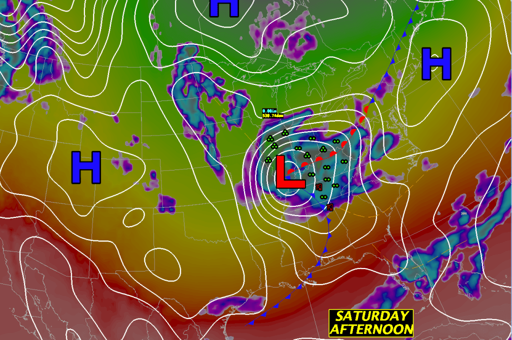
National Weather Map for Saturday, April 25. 2pm
As high pressure traverses the area to our south we should see mostly sunny skies through most of the daylight hours tomorrow. But some high clouds will advance into the area toward sunset and that will be the harbinger of deteriorating weather conditions for Sunday.
Winds will turn into the SE at all levels and this will set up decent isentropic lift, north of a warm front, over all of New England. This will in turn allow quite a bit of cloudiness to develop quickly on Sunday morning.
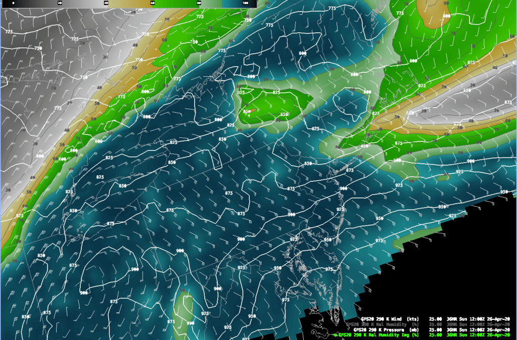
290K Isentropic Analysis Sunday, April 26 2020. 8am
By Sunday afternoon this boundary will sharpen up even further and allow some pretty heavy rainfall to develop especially as upper level support arrives to further increase the upward motion in the atmosphere. Combining all of these factors it looks like we could see up to an inch of rainfall across New England Sunday afternoon through the evening and overnight. It will also be quite windy by Sunday afternoon through Monday afternoon. Gusts of up to 40 mph could occur along the coast and on the Cape.
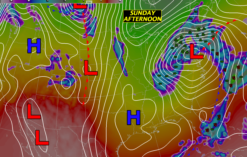
National Weather Map for Sunday April 26 2020 5pm
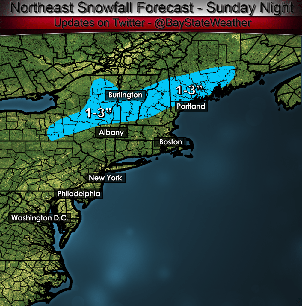
After the sun goes down on Sunday temperatures look like they may cool off quite a bit across southern and central VT, central and northern NH and Maine. This cooling may allow any rainfall that remains in New England overnight Sunday into Monday to change to snow. Right now I’m thinking that 1-3″ of snow may be possible from southern VT northeastward into central NH into interior Maine.
This storm will not get out of here quickly as the upper level low cuts off right on top of New England and allows clouds, showers and some steadier rain to linger through Tuesday morning.
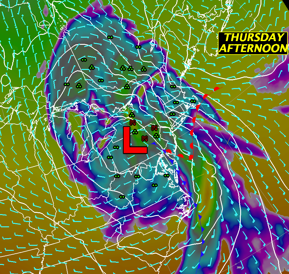
Upper air pattern on Monday afternoon.
The Sun-Tue system finally gets out of here by Wednesday and will be replaced by a ridge of high pressure which will crest over us by Wednesday evening. After the crest of the high moves by, clouds will once again press into New England ahead of the next weather system which will bring yet another slug of about .50″ to .80″ of rainfall through us. There might be more unstable air associated with this system so we might hear a rumble of thunder or see a flash of lightning on Thursday evening.
By Friday there will be yet another upper level low lagging behind the Thursday system which will make our weather fairly unsettled with showers likely especially in the afternoon.
DETAILED FORECAST:
SATURDAY MORNING: Any localized fog in western MA and CT will burn off, becoming mostly sunny everywhere. Winds light and variable. Temperatures starting off in the low to middle 40’s rising into the 50’s toward the afternoon.
SATURDAY AFTERNOON: Mostly sunny everywhere. Winds SE 5-10 mph. High temperatures in the low to middle 50’s north, near 60 in Most of Maine, central and southern VT/NH and MA away from the coast and in the low 60’s CT/RI and SE MA. High Temperatures will hold in the low to mid 50’s along the coast from Boston to Portsmouth, NH.
SATURDAY NIGHT: Clouds moving in overnight. Winds light and variable. Low temperature 40-45 across central and southern New England. Low temperatures 32-40 across Maine and northern VT/NH.
SUNDAY: Cloudy with showers developing in the morning, steadier rain developing by afternoon. Rain becoming heavy at times. Winds E-NE 10-20 mph gusting 25-30 Boston and inland. E winds 15-30 mph gusting 35-45 mph Cape and Islands. High temperature 45-50.
SUNDAY NIGHT: Rain tapering off to showers or light rain in the evening and overnight. Cloudy and raw. Any left over rain may change to snow across southern VT, central NH and downeast ME. 1-3″ of accumulation are possible. Winds NE 10-25 gusting to 25-40 overnight strongest winds along the MA east coast and downeast ME. Low temperatures 30-40 degrees. Warmest across southern CT, RI, and Eastern MA. Coldest readings through central New England and Maine.
MONDAY: Cloudy with showers and light rain. It will be breezy and raw. Winds NE to N 10-20 gusting 20-30 mph with highest winds along the coast. High 40-45 except 45-50 in central and western CT. 32-40 south central NH into ME. Coldest temps in NW Maine.
MONDAY NIGHT: Showers and rain tapering off and ending toward morning. Winds N 5-15 mph gusting to 20-25 mph mostly in eastern sections. Light and variable winds west of the CT river valley. Low temperatures 32-40 except 25-30 in NW Maine.
TUESDAY: Cloudy with showers or light rain redeveloping. High in the mid 50’s east, low to mid 60’s in central and western MA. Winds 5-10 mph with gusts to 20 mph along south and east coasts of MA and ME. High temperatures 45-52, warmest SW CT.
TUESDAY NIGHT: Showers/rain ending with clouds thinning out and clearing overnight. Light and variable winds. Low temperature 35-40 in southern New England. 30-35 central New England. 25-30 across northern VT and NH and interior Maine.
WEDNESDAY: Sunny start with clouds increasing through the day. High temperatures 50-55 along the coast, 60-65 well inland.
THURSDAY: Cloudy with heavy rain especially later in the afternoon. Rumble of thunder? High temperature 50-55.
FRIDAY: Cloudy with showers likely. High temperature 60-65.