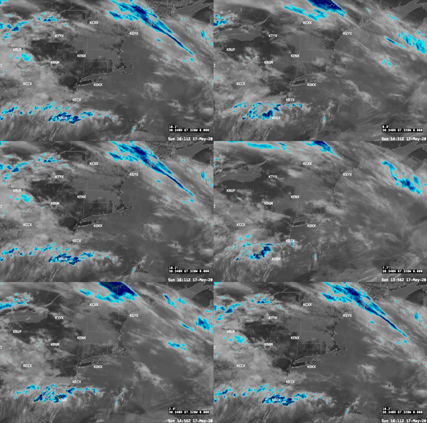
Issued: Sunday May 17 2020 12:15 pm When people ask me why I’ve lost so much hair, I give them one simple answer….”weather forecasting”. Yes, today is one of those hair pulling days forecasting New England weather. We are oh so lucky to have that dripping in moisture….gigantic refrigerator (at this time of year) calledContinue reading “Special Forecast Update”
Category Archives: Uncategorized
Arthur is Born
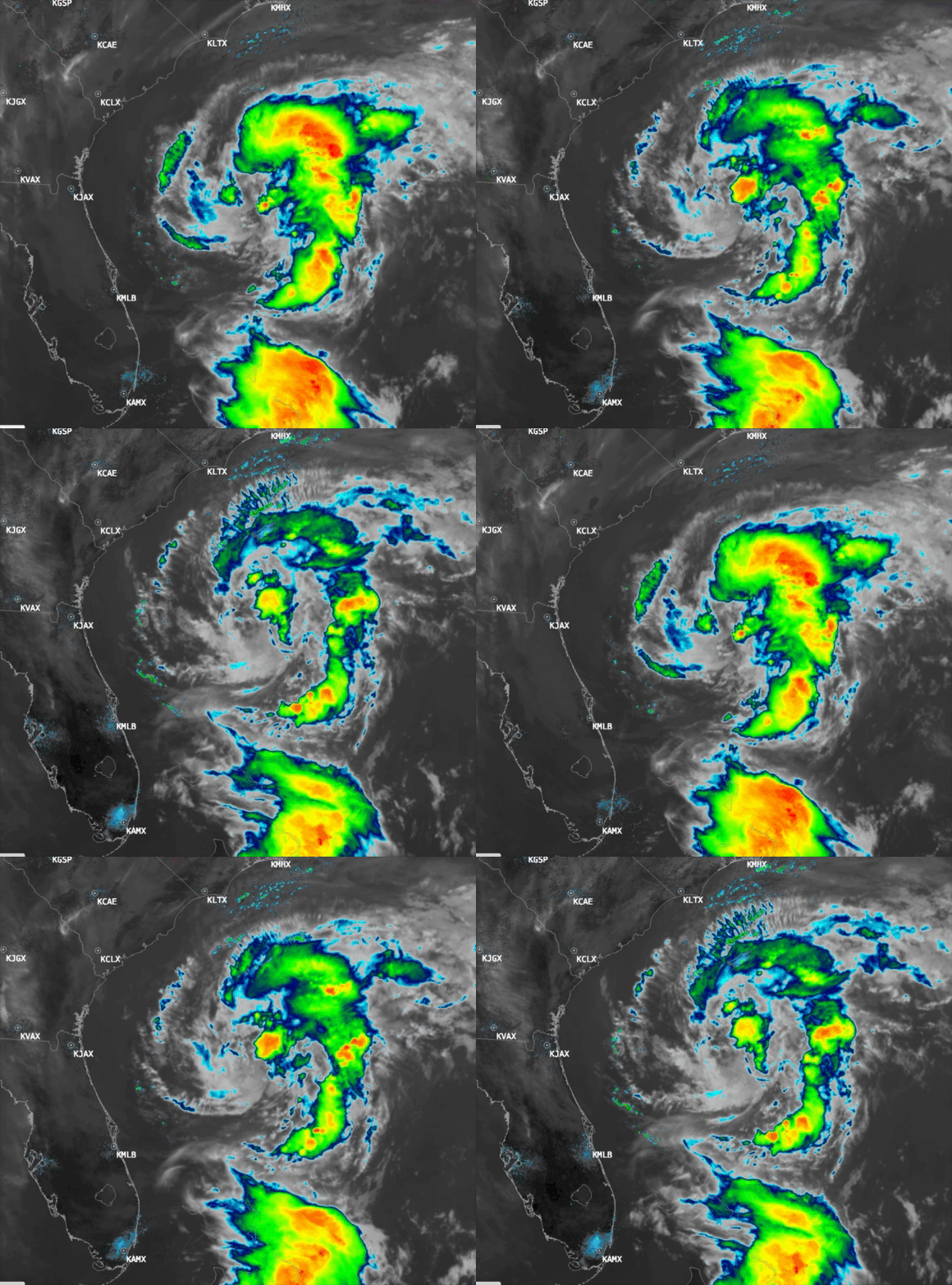
At 11pm last night the National Hurricane Center named Tropical Depression #1 “Arthur”. The current position fix of Tropical Storm Arthur is: SUMMARY OF 1100 AM EDT…1500 UTC…INFORMATION LOCATION…30.5N 77.4WABOUT 345 MI…550 KM SSW OF CAPE HATTERAS NORTH CAROLINAMAXIMUM SUSTAINED WINDS…45 MPH…75 KM/HPRESENT MOVEMENT…NNE OR 15 DEGREES AT 9 MPH…15 KM/HMINIMUM CENTRAL PRESSURE…1002 MB…29.59 INCHESContinue reading “Arthur is Born”
Tropical Depression #1 Has Formed
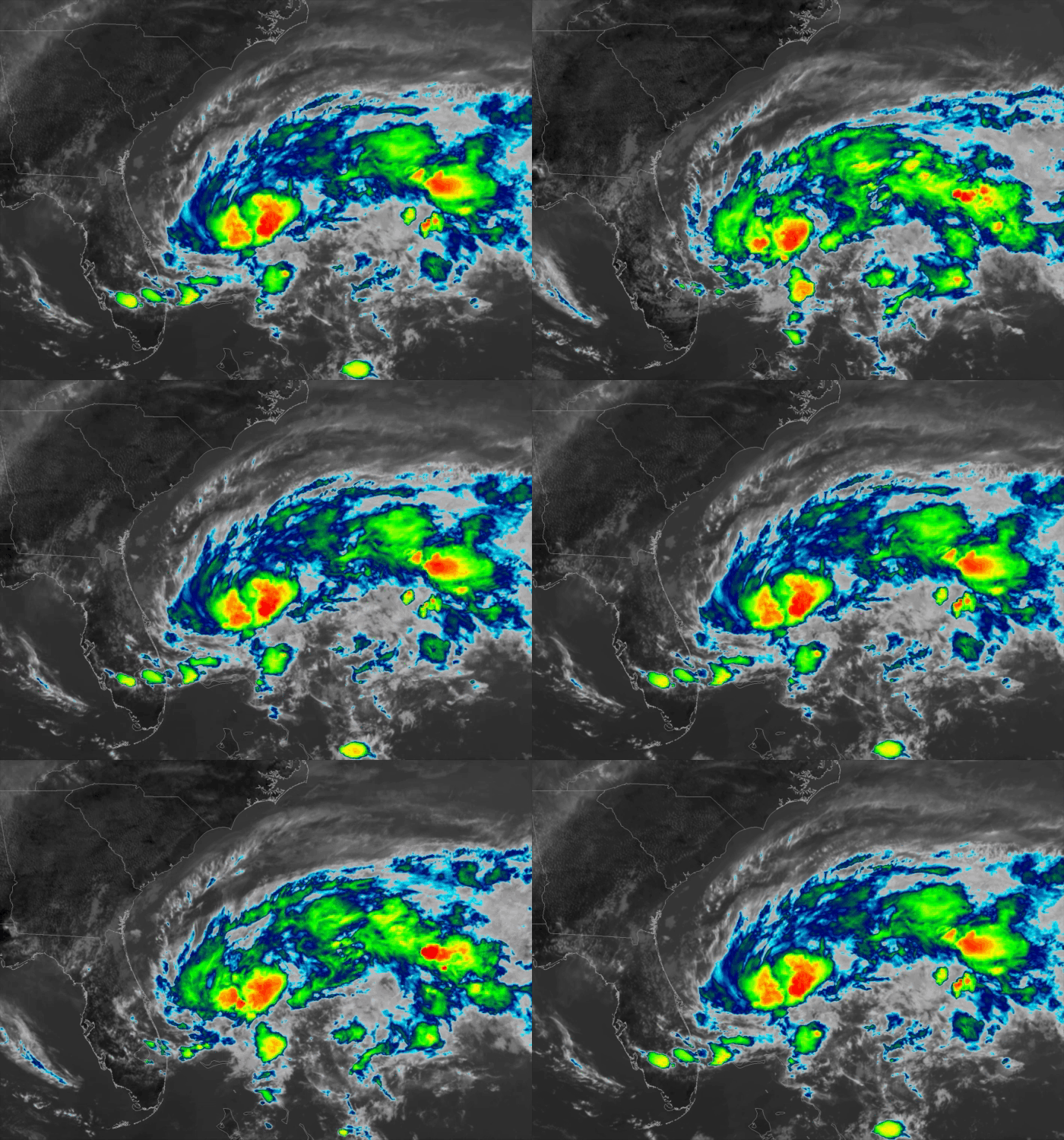
At 5:00pm the National Hurricane Center designated the disturbance off the Florida east coast as Tropical Depression #1 (TD #1), the first official tropical system of the not even officially started Atlantic hurricane season. Here is the position fix of TD#1: SUMMARY OF 500 PM EDT…2100 UTC…INFORMATION ———————————————- LOCATION…28.4N 78.6W ABOUT 125 MI…200 KM EContinue reading “Tropical Depression #1 Has Formed”
Severe Weather Potential Update
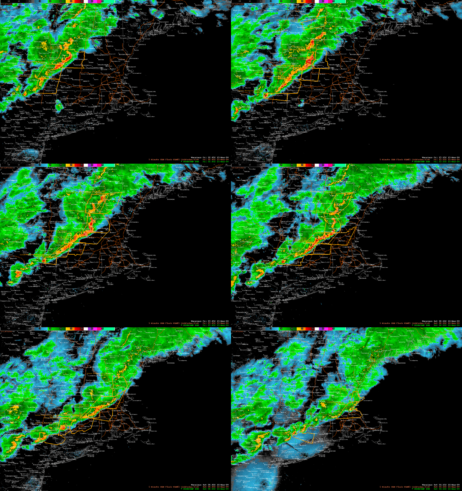
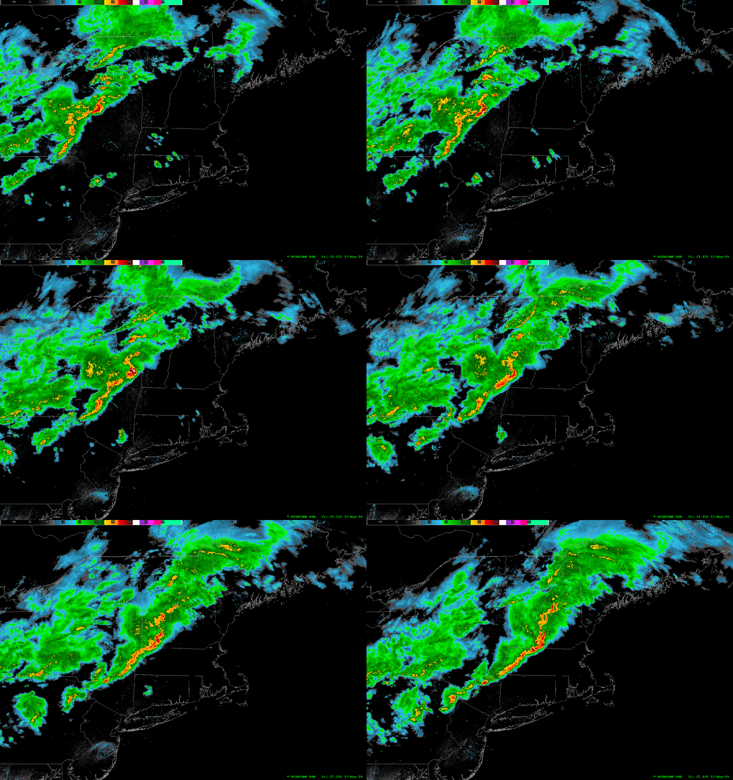
Issued Friday May 15 2020 9:15 pm The line of showers and thunderstorms we’ve been monitoring tonight has made its way through most of Massachusetts and is now pressing toward the SE into the Providence, Brockton, Taunton, and Plymouth area. The storms did weaken significantly in Eastern MA once they got inside of 495. ThisContinue reading “Severe Weather Potential Update”
Current Warnings in SNE
Severe Weather Potential Update
Issued Friday May 15 2020 7:55pm A line of strong showers and thunderstorms are pushing through central and western MA and SW and central NH as of 7:45pm this evening. This line of thunderstorms may contain cells which may generate damaging winds, hail, frequent lightning and the potential for small isolated tornadoes. The National WeatherContinue reading “Severe Weather Potential Update”
Tornado Watch
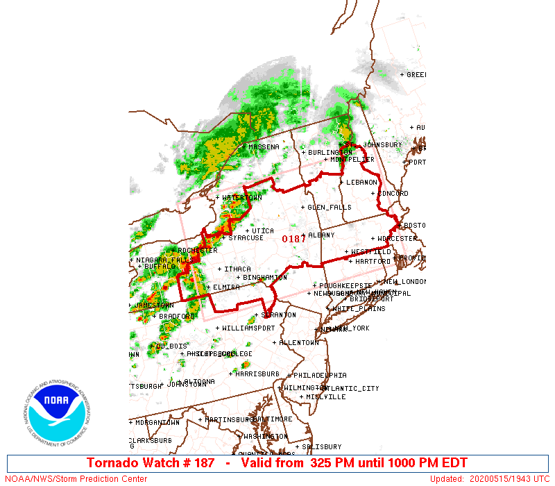
URGENT – IMMEDIATE BROADCAST REQUESTED Tornado Watch Number 187 NWS Storm Prediction Center Norman OK 325 PM EDT Fri May 15 2020 The NWS Storm Prediction Center has issued a * Tornado Watch for portions of western and central Massachusetts southern New Hampshire central through eastern New York northeast Pennsylvania southern Vermont * Effective thisContinue reading “Tornado Watch”
Special Forecast Update
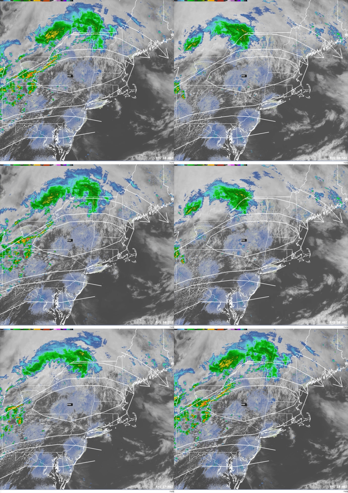
Issued: Friday May 15 2020 3:00 pm …SEVERE WEATHER POSSIBLE THIS EVENING…. The Storm Prediction Center has placed all but SE CT/Southern RI/and SE MA in either the Slight or Enhanced risk category for severe weather today. Based on current data thunderstorms are blossoming in western New York state and northern Pennsylvania. This is inContinue reading “Special Forecast Update”
Special Forecast Update
Issued: Monday May 11 2020 9:55 am ….WHERE IS THE RAIN? IT’S COMING LATER TODAY…. So, looking at the forecast I issued on Saturday I figured that clouds and rain today would be a safe bet. Yeah, right. The system that will ultimately bring those two things to us today is a little slower gettingContinue reading “Special Forecast Update”
Special Forecast Update
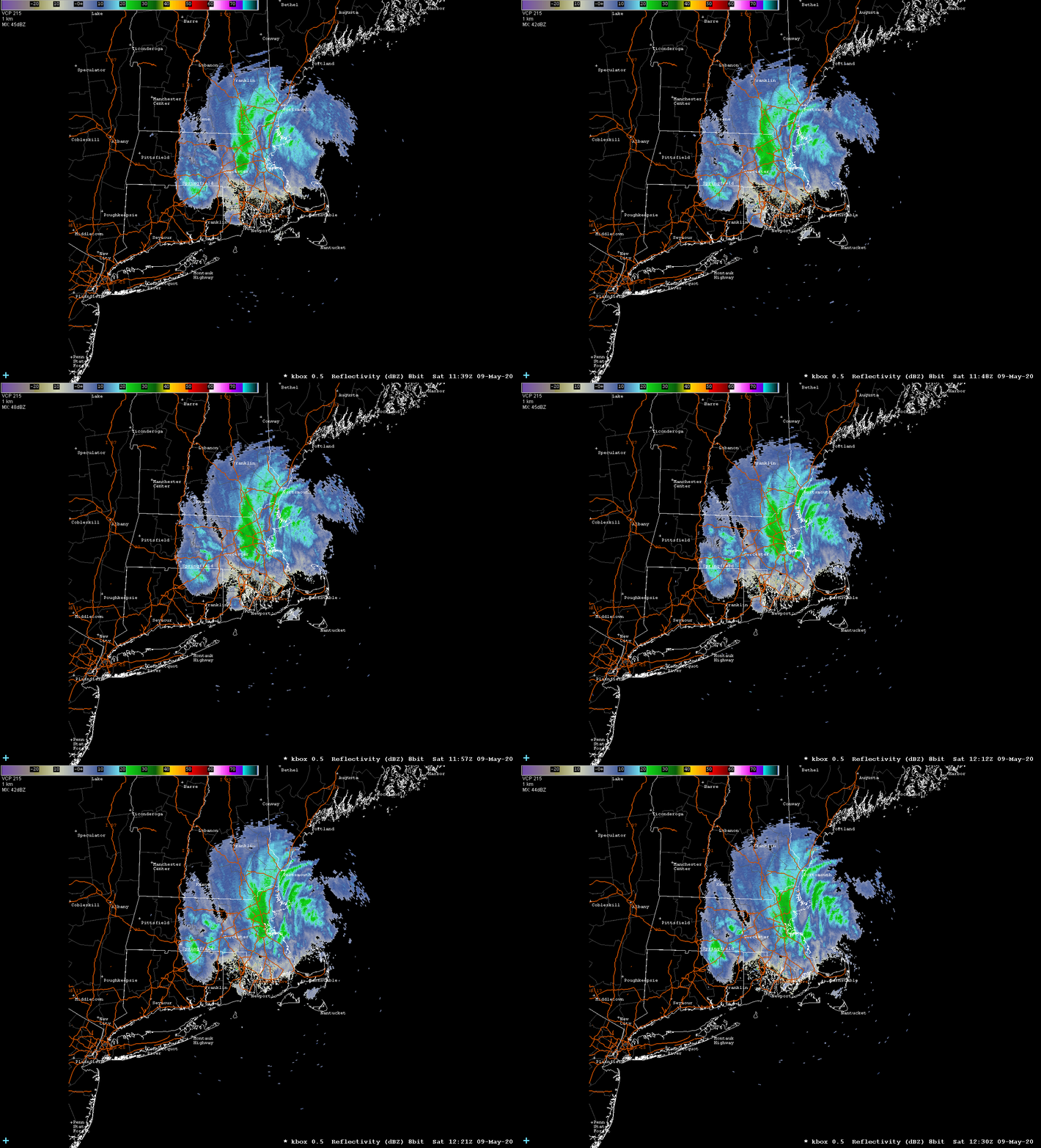
Issued: Saturday May 9 2020 8:45 am ….JUST A TEASE…..A LITTLE SNOW TO START THE DAY…..NO ACCUMULATION…. Good morning! I know, many of you are reading this and are saying to yourself “I thought you said it wouldn’t snow!” Well, I did say there wouldn’t be any accumulation and that’s my story still and I’mContinue reading “Special Forecast Update”
